Blakeview geodata
Blakeview (South Australia) is a section of populated place; located in Australia in Australia/Adelaide (GMT+10.5) time zone. With population of 7,043 people, there are 972 cities with bigger population in this country. Compared to other cities in Australia, 64.6% of cities are located further ↑North; 78% of cities are located further →East and 64.4% of cities have lower elevation than Blakeview. Note1


Blakeview GPS coordinates[2]
34° 40' 32.376" South, 138° 42' 36.36" East
| Map corner | latitude | longitude |
|---|---|---|
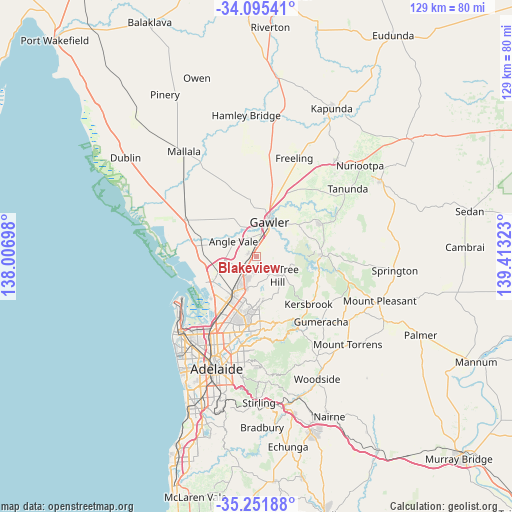
| Upper-left | -34.09541°, | 138.00698° |
| Center: | -34.67566°, | 138.7101° |
| Lower-right: | -35.25188°, | 139.41323° |
| Map W x H: | 128.6×128.6 km | = 79.9×79.9mi |
| max Lat: | -10.58257° ⇑64.6% North |
| Blakeview: | -34.67566° |
| min Lat: | ⇓35.4% South -43.31423° |
| min Long | Blakeview | max Long |
| 113.53327° | 138.7101° | 153.61246° |
| W 22%⇐ | ⇒78% E |
Elevation
Elevation of Blakeview is 78 m = 256 ft, and this is 44 m = 144 ft below average elevation for this country.
| Max E: |
1715 m = 5627 ft | 35.6% |
| Avg. | 122 m = 400 ft | |
| Blakeview | 78 m = 256 ft | |
Min E: |
-2 m = -7 ft | 64.4% |
See also: Australia elevation on elevation.city.
Geographical zone
Blakeview is located in South temperate zone (between Tropic of Capricorn and the Antarctic Circle). Distance of this Southern Tropic circle is 1249.7 km =776.5 mi to North.| Distance of | km | miles | from Blakeview |
|---|---|---|---|
| Equator | 3855.6 | 2395.8 | to North |
| Tropic Capricorn | 1249.7 | 776.5 | to North |
| Antarctic Circle | 3545.6 | 2203.1 | to South |
| South Pole | 6151.5 | 3822.4 | to South |


Nearby cities:
15 places around Blakeview: (largest is in red/bold)
• Andrews Farm
4.4 km =2.7 mi,  269°
269°
• Craigmore
2.8 km =1.7 mi,  181°
181°
• Davoren Park
4.1 km =2.5 mi,  246°
246°
• Elizabeth
5.7 km =3.5 mi,  211°
211°
• Elizabeth Downs
3.2 km =2 mi, 212°
• Elizabeth East
6.1 km =3.8 mi,  204°
204°
• Elizabeth North
4.7 km =2.9 mi,  221°
221°
• Elizabeth Park
4.4 km =2.7 mi, 210°
• Evanston Gardens
5.9 km =3.7 mi,  10°
10°
• Kudla
3.8 km =2.4 mi,  348°
348°
• Munno Para
1.2 km =0.7 mi,  317°
317°
• Munno Para West
3 km =1.9 mi,  294°
294°
• One Tree Hill
5.8 km =3.6 mi,  117°
117°
• Smithfield
2.6 km =1.6 mi, 250°
• Smithfield Plains
3 km =1.9 mi, 268°
Sources, notices
• [Note1] Compared only with cities in Australia existing in our database
• [Src1] Map data: © OpenStreetMap contributors (CC-BY-SA)
• [Src2] Other city data from geonames.org with taken over terms of usage.
• [Src3] Geographical zone / Annual Mean Temperature by Robert A. Rohde @ Wikipedia
