Greenfields geodata
Greenfields (Western Australia) is a section of populated place; located in Australia in Australia/Perth (GMT+8) time zone. With population of 9,620 people, there are 636 cities with bigger population in this country. Compared to other cities in Australia, 61.5% of cities are located further ↓South; 97.1% of cities are located further →East and 95.5% of cities have higher elevation than Greenfields. Note1


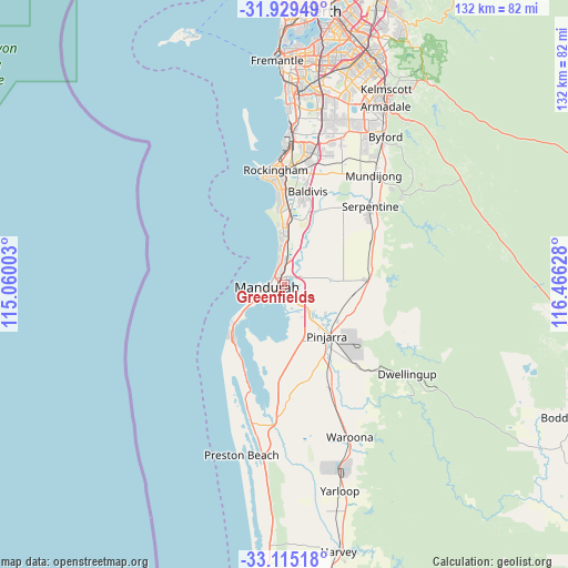
Greenfields GPS coordinates[2]
32° 31' 27.444" South, 115° 45' 47.34" East
| Map corner | latitude | longitude |
|---|---|---|
| Upper-left | -31.92949°, | 115.06003° |
| Center: | -32.52429°, | 115.76315° |
| Lower-right: | -33.11518°, | 116.46628° |
| Map W x H: | 131.8×131.8 km | = 81.9×81.9mi |
| max Lat: | -10.58257° ⇑38.5% North |
| Greenfields: | -32.52429° |
| min Lat: | ⇓61.5% South -43.31423° |
| min Long | Greenfields | max Long |
| 113.53327° | 115.76315° | 153.61246° |
| W 2.9%⇐ | ⇒97.1% E |
Elevation
Elevation of Greenfields is 6 m = 20 ft, and this is 116 m = 381 ft below average elevation for this country.
| Max E: |
1715 m = 5627 ft | 95.5% |
| Avg. | 122 m = 400 ft | |
| Greenfields | 6 m = 20 ft | |
Min E: |
-2 m = -7 ft | 4.5% |
See also: Australia elevation on elevation.city.
Geographical zone
Greenfields is located in South temperate zone (between Tropic of Capricorn and the Antarctic Circle). Distance of this Southern Tropic circle is 1010.4 km =627.8 mi to North.| Distance of | km | miles | from Greenfields |
|---|---|---|---|
| Equator | 3616.4 | 2247.1 | to North |
| Tropic Capricorn | 1010.4 | 627.8 | to North |
| Antarctic Circle | 3784.8 | 2351.8 | to South |
| South Pole | 6390.7 | 3971 | to South |


Nearby cities:
15 places around Greenfields: (largest is in red/bold)
• Barragup
3.2 km =2 mi,  151°
151°
• Coodanup
3.2 km =2 mi,  196°
196°
• Dudley Park
4.3 km =2.7 mi,  224°
224°
• Erskine
6.4 km =4 mi,  235°
235°
• Furnissdale
3.8 km =2.4 mi,  183°
183°
• Halls Head
6.6 km =4.1 mi,  251°
251°
• Lakelands
5.9 km =3.7 mi,  8°
8°
• Madora Bay
6.2 km =3.9 mi,  350°
350°
• Mandurah
3.9 km =2.4 mi,  265°
265°
• Mandurah city centre
2.8 km =1.7 mi, 265°
• Meadow Springs
3.2 km =2 mi,  343°
343°
• North Yunderup
6.6 km =4.1 mi, 153°
• Parklands
3.3 km =2.1 mi,  16°
16°
• San Remo
4.2 km =2.6 mi, 335°
• Silver Sands
3.1 km =1.9 mi,  304°
304°
Sources, notices
• [Note1] Compared only with cities in Australia existing in our database
• [Src1] Map data: © OpenStreetMap contributors (CC-BY-SA)
• [Src2] Other city data from geonames.org with taken over terms of usage.
• [Src3] Geographical zone / Annual Mean Temperature by Robert A. Rohde @ Wikipedia
