Barragup geodata
Barragup (Western Australia) is a section of populated place; located in Australia in Australia/Perth (GMT+8) time zone. With population of 883 people, there are 3998 cities with bigger population in this country. Compared to other cities in Australia, 61.3% of cities are located further ↓South; 96.6% of cities are located further →East and 91.8% of cities have higher elevation than Barragup. Note1


Barragup GPS coordinates[2]
32° 32' 59.316" South, 115° 46' 46.524" East
| Map corner | latitude | longitude |
|---|---|---|
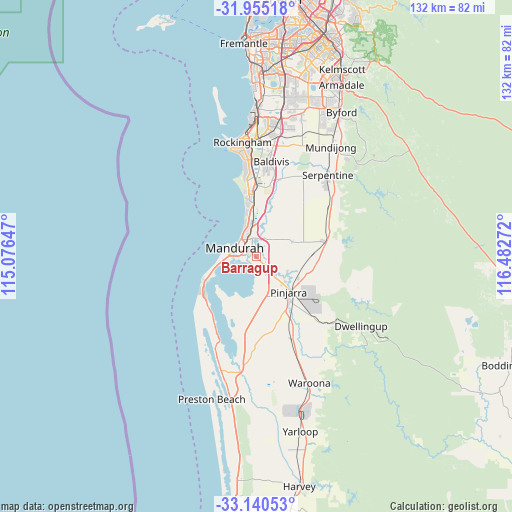
| Upper-left | -31.95518°, | 115.07647° |
| Center: | -32.54981°, | 115.77959° |
| Lower-right: | -33.14053°, | 116.48272° |
| Map W x H: | 131.8×131.8 km | = 81.9×81.9mi |
| max Lat: | -10.58257° ⇑38.7% North |
| Barragup: | -32.54981° |
| min Lat: | ⇓61.3% South -43.31423° |
| min Long | Barragup | max Long |
| 113.53327° | 115.77959° | 153.61246° |
| W 3.4%⇐ | ⇒96.6% E |
Elevation
Elevation of Barragup is 8 m = 26 ft, and this is 114 m = 374 ft below average elevation for this country.
| Max E: |
1715 m = 5627 ft | 91.8% |
| Avg. | 122 m = 400 ft | |
| Barragup | 8 m = 26 ft | |
Min E: |
-2 m = -7 ft | 8.2% |
See also: Australia elevation on elevation.city.
Geographical zone
Barragup is located in South temperate zone (between Tropic of Capricorn and the Antarctic Circle). Distance of this Southern Tropic circle is 1013.3 km =629.6 mi to North.| Distance of | km | miles | from Barragup |
|---|---|---|---|
| Equator | 3619.2 | 2248.9 | to North |
| Tropic Capricorn | 1013.3 | 629.6 | to North |
| Antarctic Circle | 3782 | 2350 | to South |
| South Pole | 6387.9 | 3969.3 | to South |


Nearby cities:
15 places around Barragup: (largest is in red/bold)
• Coodanup
2.5 km =1.6 mi,  264°
264°
• Dudley Park
4.6 km =2.9 mi,  266°
266°
• Erskine
6.9 km =4.3 mi, 263°
• Furnissdale
2 km =1.2 mi,  241°
241°
• Greenfields
3.2 km =2 mi,  331°
331°
• Halls Head
7.8 km =4.8 mi,  275°
275°
• Mandurah
6 km =3.7 mi,  295°
295°
• Mandurah city centre
5 km =3.1 mi, 301°
• Meadow Springs
6.3 km =3.9 mi,  337°
337°
• North Yunderup
3.4 km =2.1 mi,  156°
156°
• Parklands
6.1 km =3.8 mi,  354°
354°
• Ravenswood
6.1 km =3.8 mi,  126°
126°
• San Remo
7.4 km =4.6 mi, 333°
• Silver Sands
6.1 km =3.8 mi,  318°
318°
• South Yunderup
3.9 km =2.4 mi,  179°
179°
Sources, notices
• [Note1] Compared only with cities in Australia existing in our database
• [Src1] Map data: © OpenStreetMap contributors (CC-BY-SA)
• [Src2] Other city data from geonames.org with taken over terms of usage.
• [Src3] Geographical zone / Annual Mean Temperature by Robert A. Rohde @ Wikipedia
