Gowrie geodata
Gowrie (ACT) is a section of populated place; located in Australia in Australia/Sydney (GMT+11) time zone. With population of 2,967 people, there are 2269 cities with bigger population in this country. Compared to other cities in Australia, 76.6% of cities are located further ↑North; 54.1% of cities are located further ←West and 96.4% of cities have lower elevation than Gowrie. Note1


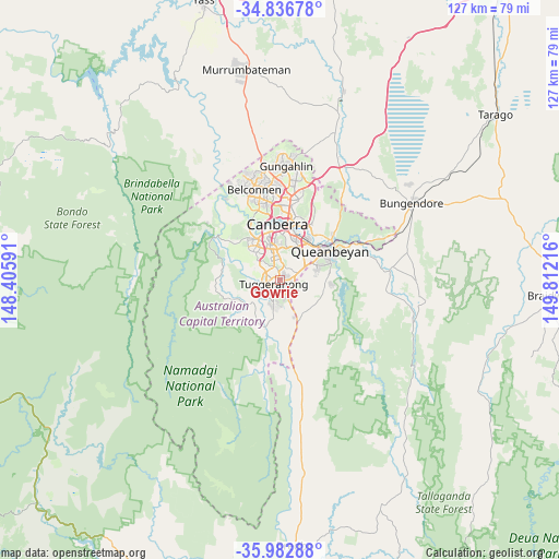
Gowrie GPS coordinates[2]
35° 24' 42.732" South, 149° 6' 32.508" East
| Map corner | latitude | longitude |
|---|---|---|
| Upper-left | -34.83678°, | 148.40591° |
| Center: | -35.41187°, | 149.10903° |
| Lower-right: | -35.98288°, | 149.81216° |
| Map W x H: | 127.4×127.4 km | = 79.2×79.2mi |
| max Lat: | -10.58257° ⇑76.6% North |
| Gowrie: | -35.41187° |
| min Lat: | ⇓23.4% South -43.31423° |
| min Long | Gowrie | max Long |
| 113.53327° | 149.10903° | 153.61246° |
| W 54.1%⇐ | ⇒45.9% E |
Elevation
Elevation of Gowrie is 613 m = 2011 ft, and this is 491 m = 1611 ft above average elevation for this country.
| Max E: |
1715 m = 5627 ft | 3.6% |
| Gowrie | 613 m 2011 ft | |
| Avg. | 122 m = 400 ft | |
Min E: |
-2 m = -7 ft | 96.4% |
See also: Australia elevation on elevation.city.
Geographical zone
Gowrie is located in South temperate zone (between Tropic of Capricorn and the Antarctic Circle). Distance of this Southern Tropic circle is 1331.5 km =827.4 mi to North.| Distance of | km | miles | from Gowrie |
|---|---|---|---|
| Equator | 3937.4 | 2446.6 | to North |
| Tropic Capricorn | 1331.5 | 827.4 | to North |
| Antarctic Circle | 3463.7 | 2152.2 | to South |
| South Pole | 6069.6 | 3771.5 | to South |


Nearby cities:
15 places around Gowrie: (largest is in red/bold)
• Bonython
3.7 km =2.3 mi,  229°
229°
• Calwell
3.2 km =2 mi,  183°
183°
• Chisholm
1.7 km =1.1 mi,  92°
92°
• Fadden
1 km =0.6 mi,  42°
42°
• Farrer
3.9 km =2.4 mi,  354°
354°
• Gilmore
2.5 km =1.6 mi,  111°
111°
• Greenway
3.9 km =2.4 mi,  259°
259°
• Isaacs
4.8 km =3 mi,  7°
7°
• Isabella Plains
2.6 km =1.6 mi, 226°
• Macarthur
1.7 km =1.1 mi,  78°
78°
• Monash
1.7 km =1.1 mi, 255°
• Oxley
2.8 km =1.7 mi,  275°
275°
• Richardson
1.8 km =1.1 mi,  166°
166°
• Theodore
4.3 km =2.7 mi, 167°
• Wanniassa
2.3 km =1.4 mi,  313°
313°
Sources, notices
• [Note1] Compared only with cities in Australia existing in our database
• [Src1] Map data: © OpenStreetMap contributors (CC-BY-SA)
• [Src2] Other city data from geonames.org with taken over terms of usage.
• [Src3] Geographical zone / Annual Mean Temperature by Robert A. Rohde @ Wikipedia
