Cooee Bay geodata
Cooee Bay (Queensland) is a section of populated place; located in Australia in Australia/Brisbane (GMT+10) time zone. With population of 1,006 people, there are 3809 cities with bigger population in this country. Compared to other cities in Australia, 92.2% of cities are located further ↓South; 61.8% of cities are located further ←West and 83.5% of cities have higher elevation than Cooee Bay. Note1


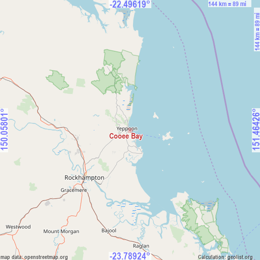
Cooee Bay GPS coordinates[2]
23° 8' 39.372" South, 150° 45' 40.068" East
| Map corner | latitude | longitude |
|---|---|---|
| Upper-left | -22.49619°, | 150.05801° |
| Center: | -23.14427°, | 150.76113° |
| Lower-right: | -23.78924°, | 151.46426° |
| Map W x H: | 143.8×143.8 km | = 89.4×89.4mi |
| max Lat: | -10.58257° ⇑7.8% North |
| Cooee Bay: | -23.14427° |
| min Lat: | ⇓92.2% South -43.31423° |
| min Long | Cooee Bay | max Long |
| 113.53327° | 150.76113° | 153.61246° |
| W 61.8%⇐ | ⇒38.2% E |
Elevation
Elevation of Cooee Bay is 13 m = 43 ft, and this is 109 m = 358 ft below average elevation for this country.
| Max E: |
1715 m = 5627 ft | 83.5% |
| Avg. | 122 m = 400 ft | |
| Cooee Bay | 13 m = 43 ft | |
Min E: |
-2 m = -7 ft | 16.5% |
See also: Australia elevation on elevation.city.
Geographical zone
Cooee Bay is located in South Torrid zone (between Equator and Tropic of Capricorn). Distance of this Southern Tropic circle is 32.5 km =20.2 mi to South.| Distance of | km | miles | from Cooee Bay |
|---|---|---|---|
| Equator | 2573.4 | 1599 | to North |
| Tropic Capricorn | 32.5 | 20.2 | to South |
| Antarctic Circle | 4827.8 | 2999.9 | to South |
| South Pole | 7433.7 | 4619.1 | to South |


Nearby cities:
15 places around Cooee Bay: (largest is in red/bold)
• Barlows Hill
4.4 km =2.7 mi,  338°
338°
• Barmaryee
4.7 km =2.9 mi,  284°
284°
• Bondoola
8.3 km =5.2 mi,  252°
252°
• Farnborough
6.2 km =3.9 mi, 341°
• Inverness
5 km =3.1 mi,  309°
309°
• Kinka Beach
9.7 km =6 mi,  157°
157°
• Lammermoor
1.8 km =1.1 mi,  181°
181°
• Mulambin
5.6 km =3.5 mi,  149°
149°
• Pacific Heights
5.6 km =3.5 mi, 335°
• Rosslyn
3 km =1.9 mi,  144°
144°
• Tanby
10 km =6.2 mi,  186°
186°
• Taranganba
1 km =0.6 mi,  269°
269°
• Taroomball
3.6 km =2.2 mi,  209°
209°
• Yeppoon
2.6 km =1.6 mi,  318°
318°
• Yeppoon city centre
3 km =1.9 mi,  302°
302°
Sources, notices
• [Note1] Compared only with cities in Australia existing in our database
• [Src1] Map data: © OpenStreetMap contributors (CC-BY-SA)
• [Src2] Other city data from geonames.org with taken over terms of usage.
• [Src3] Geographical zone / Annual Mean Temperature by Robert A. Rohde @ Wikipedia
