Charnwood geodata
Charnwood (ACT) is a section of populated place; located in Australia in Australia/Sydney (GMT+11) time zone. With population of 2,941 people, there are 2286 cities with bigger population in this country. Compared to other cities in Australia, 74.4% of cities are located further ↑North; 52.8% of cities are located further ←West and 95.1% of cities have lower elevation than Charnwood. Note1


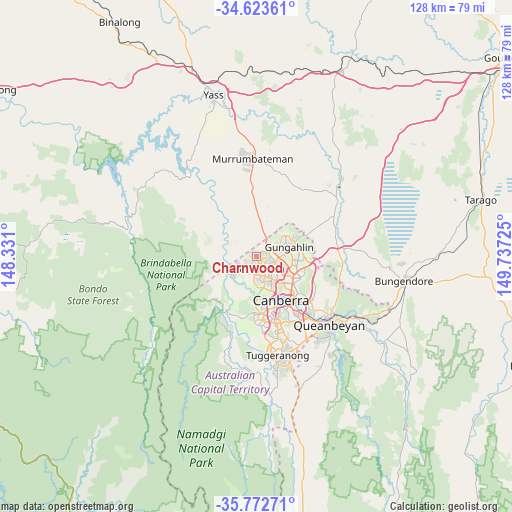
Charnwood GPS coordinates[2]
35° 12' 0.684" South, 149° 2' 2.832" East
| Map corner | latitude | longitude |
|---|---|---|
| Upper-left | -34.62361°, | 148.331° |
| Center: | -35.20019°, | 149.03412° |
| Lower-right: | -35.77271°, | 149.73725° |
| Map W x H: | 127.8×127.8 km | = 79.4×79.4mi |
| max Lat: | -10.58257° ⇑74.4% North |
| Charnwood: | -35.20019° |
| min Lat: | ⇓25.6% South -43.31423° |
| min Long | Charnwood | max Long |
| 113.53327° | 149.03412° | 153.61246° |
| W 52.8%⇐ | ⇒47.2% E |
Elevation
Elevation of Charnwood is 584 m = 1916 ft, and this is 462 m = 1516 ft above average elevation for this country.
| Max E: |
1715 m = 5627 ft | 4.9% |
| Charnwood | 584 m 1916 ft | |
| Avg. | 122 m = 400 ft | |
Min E: |
-2 m = -7 ft | 95.1% |
See also: Australia elevation on elevation.city.
Geographical zone
Charnwood is located in South temperate zone (between Tropic of Capricorn and the Antarctic Circle). Distance of this Southern Tropic circle is 1308 km =812.8 mi to North.| Distance of | km | miles | from Charnwood |
|---|---|---|---|
| Equator | 3913.9 | 2432 | to North |
| Tropic Capricorn | 1308 | 812.8 | to North |
| Antarctic Circle | 3487.3 | 2166.9 | to South |
| South Pole | 6093.2 | 3786.1 | to South |


Nearby cities:
15 places around Charnwood: (largest is in red/bold)
• Belconnen
5.1 km =3.2 mi,  145°
145°
• Dunlop
1.5 km =0.9 mi,  297°
297°
• Evatt
3.4 km =2.1 mi,  112°
112°
• Florey
3.2 km =2 mi, 153°
• Flynn
1.1 km =0.7 mi,  125°
125°
• Fraser
1.4 km =0.9 mi,  47°
47°
• Higgins
3.6 km =2.2 mi,  189°
189°
• Holt
3.4 km =2.1 mi,  216°
216°
• Latham
1.8 km =1.1 mi, 187°
• Macgregor
2.4 km =1.5 mi,  243°
243°
• McKellar
4.3 km =2.7 mi,  116°
116°
• Melba
2.1 km =1.3 mi, 121°
• Page
4.5 km =2.8 mi,  161°
161°
• Scullin
3.9 km =2.4 mi,  173°
173°
• Spence
2.8 km =1.7 mi,  86°
86°
Sources, notices
• [Note1] Compared only with cities in Australia existing in our database
• [Src1] Map data: © OpenStreetMap contributors (CC-BY-SA)
• [Src2] Other city data from geonames.org with taken over terms of usage.
• [Src3] Geographical zone / Annual Mean Temperature by Robert A. Rohde @ Wikipedia
