Florey geodata
Florey (ACT) is a section of populated place; located in Australia in Australia/Sydney (GMT+11) time zone. With population of 4,690 people, there are 1572 cities with bigger population in this country. Compared to other cities in Australia, 74.7% of cities are located further ↑North; 53.1% of cities are located further ←West and 95.5% of cities have lower elevation than Florey. Note1


Florey GPS coordinates[2]
35° 13' 33.168" South, 149° 3' 0" East
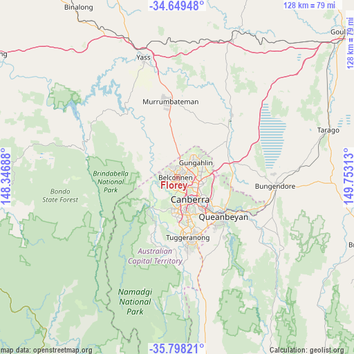
| Map corner | latitude | longitude |
|---|---|---|
| Upper-left | -34.64948°, | 148.34688° |
| Center: | -35.22588°, | 149.05° |
| Lower-right: | -35.79821°, | 149.75313° |
| Map W x H: | 127.7×127.7 km | = 79.3×79.3mi |
| max Lat: | -10.58257° ⇑74.7% North |
| Florey: | -35.22588° |
| min Lat: | ⇓25.3% South -43.31423° |
| min Long | Florey | max Long |
| 113.53327° | 149.05° | 153.61246° |
| W 53.1%⇐ | ⇒46.9% E |
Elevation
Elevation of Florey is 592 m = 1942 ft, and this is 470 m = 1542 ft above average elevation for this country.
| Max E: |
1715 m = 5627 ft | 4.5% |
| Florey | 592 m 1942 ft | |
| Avg. | 122 m = 400 ft | |
Min E: |
-2 m = -7 ft | 95.5% |
See also: Australia elevation on elevation.city.
Geographical zone
Florey is located in South temperate zone (between Tropic of Capricorn and the Antarctic Circle). Distance of this Southern Tropic circle is 1310.8 km =814.5 mi to North.| Distance of | km | miles | from Florey |
|---|---|---|---|
| Equator | 3916.8 | 2433.8 | to North |
| Tropic Capricorn | 1310.8 | 814.5 | to North |
| Antarctic Circle | 3484.4 | 2165.1 | to South |
| South Pole | 6090.3 | 3784.3 | to South |


Nearby cities:
15 places around Florey: (largest is in red/bold)
• Belconnen
2 km =1.2 mi,  132°
132°
• Charnwood
3.2 km =2 mi,  333°
333°
• Evatt
2.3 km =1.4 mi,  47°
47°
• Flynn
2.3 km =1.4 mi,  345°
345°
• Hawker
2.6 km =1.6 mi,  207°
207°
• Higgins
2.2 km =1.4 mi,  250°
250°
• Holt
3.5 km =2.2 mi,  272°
272°
• Latham
2 km =1.2 mi,  301°
301°
• Macquarie
3.1 km =1.9 mi,  156°
156°
• McKellar
2.6 km =1.6 mi,  69°
69°
• Melba
1.8 km =1.1 mi,  11°
11°
• Page
1.4 km =0.9 mi,  180°
180°
• Scullin
1.4 km =0.9 mi,  225°
225°
• Spence
3.3 km =2.1 mi,  23°
23°
• Weetangera
2.7 km =1.7 mi, 180°
Sources, notices
• [Note1] Compared only with cities in Australia existing in our database
• [Src1] Map data: © OpenStreetMap contributors (CC-BY-SA)
• [Src2] Other city data from geonames.org with taken over terms of usage.
• [Src3] Geographical zone / Annual Mean Temperature by Robert A. Rohde @ Wikipedia
