Rangewood geodata
Rangewood (Queensland) is a section of populated place; located in Australia in Australia/Brisbane (GMT+10) time zone. With population of 1,016 people, there are 3797 cities with bigger population in this country. Compared to other cities in Australia, 95% of cities are located further ↓South; 55% of cities are located further →East and 58.4% of cities have higher elevation than Rangewood. Note1


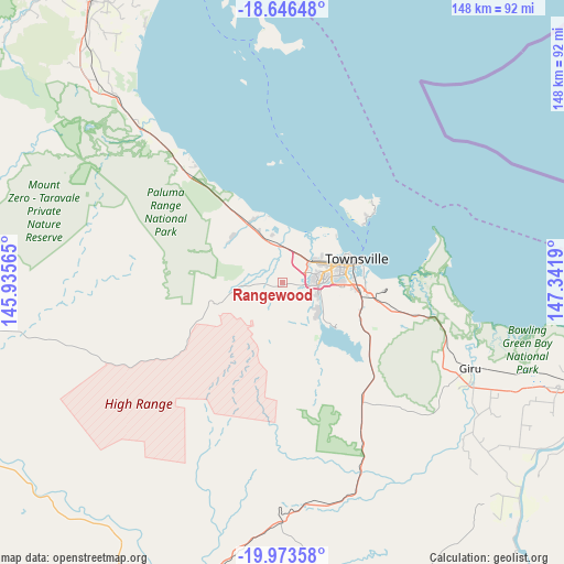
Rangewood GPS coordinates[2]
19° 18' 40.968" South, 146° 38' 19.572" East
| Map corner | latitude | longitude |
|---|---|---|
| Upper-left | -18.64648°, | 145.93565° |
| Center: | -19.31138°, | 146.63877° |
| Lower-right: | -19.97358°, | 147.3419° |
| Map W x H: | 147.6×147.6 km | = 91.7×91.7mi |
| max Lat: | -10.58257° ⇑5% North |
| Rangewood: | -19.31138° |
| min Lat: | ⇓95% South -43.31423° |
| min Long | Rangewood | max Long |
| 113.53327° | 146.63877° | 153.61246° |
| W 45%⇐ | ⇒55% E |
Elevation
Elevation of Rangewood is 34 m = 112 ft, and this is 88 m = 289 ft below average elevation for this country.
| Max E: |
1715 m = 5627 ft | 58.4% |
| Avg. | 122 m = 400 ft | |
| Rangewood | 34 m = 112 ft | |
Min E: |
-2 m = -7 ft | 41.6% |
See also: Australia elevation on elevation.city.
Geographical zone
Rangewood is located in South Torrid zone (between Equator and Tropic of Capricorn). Distance of this Southern Tropic circle is 458.7 km =285 mi to South.| Distance of | km | miles | from Rangewood |
|---|---|---|---|
| Equator | 2147.2 | 1334.2 | to North |
| Tropic Capricorn | 458.7 | 285 | to South |
| Antarctic Circle | 5253.9 | 3264.6 | to South |
| South Pole | 7859.8 | 4883.9 | to South |


Nearby cities:
15 places around Rangewood: (largest is in red/bold)
• Alice River
3.7 km =2.3 mi,  225°
225°
• Black River
9.8 km =6.1 mi,  347°
347°
• Bohle Plains
5.6 km =3.5 mi,  92°
92°
• Burdell
9.2 km =5.7 mi,  42°
42°
• Condon
8.4 km =5.2 mi,  103°
103°
• Cranbrook
12 km =7.5 mi, 86°
• Deeragun
8.1 km =5 mi,  28°
28°
• Douglas
12 km =7.5 mi, 96°
• Heatley
12.3 km =7.6 mi,  79°
79°
• Jensen
7.5 km =4.7 mi,  11°
11°
• Kelso
12.1 km =7.5 mi,  135°
135°
• Kirwan
9.1 km =5.7 mi, 84°
• Mount Low
9.4 km =5.8 mi,  20°
20°
• Rasmussen
9.9 km =6.2 mi,  117°
117°
• Shaw
8.7 km =5.4 mi,  51°
51°
Sources, notices
• [Note1] Compared only with cities in Australia existing in our database
• [Src1] Map data: © OpenStreetMap contributors (CC-BY-SA)
• [Src2] Other city data from geonames.org with taken over terms of usage.
• [Src3] Geographical zone / Annual Mean Temperature by Robert A. Rohde @ Wikipedia
