Aberfoyle Park geodata
Aberfoyle Park (South Australia) is a section of populated place; located in Australia in Australia/Adelaide (GMT+10.5) time zone. With population of 10,795 people, there are 508 cities with bigger population in this country. Compared to other cities in Australia, 72.8% of cities are located further ↑North; 81.6% of cities are located further →East and 79.6% of cities have lower elevation than Aberfoyle Park. Note1


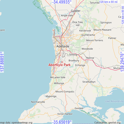
Aberfoyle Park GPS coordinates[2]
35° 4' 36.48" South, 138° 35' 29.868" East
| Map corner | latitude | longitude |
|---|---|---|
| Upper-left | -34.49935°, | 137.88851° |
| Center: | -35.0768°, | 138.59163° |
| Lower-right: | -35.65019°, | 139.29476° |
| Map W x H: | 128×128 km | = 79.5×79.5mi |
| max Lat: | -10.58257° ⇑72.8% North |
| Aberfoyle Park: | -35.0768° |
| min Lat: | ⇓27.2% South -43.31423° |
| min Long | Aberfoyle Park | max Long |
| 113.53327° | 138.59163° | 153.61246° |
| W 18.4%⇐ | ⇒81.6% E |
Elevation
Elevation of Aberfoyle Park is 177 m = 581 ft, and this is 55 m = 180 ft above average elevation for this country.
| Max E: |
1715 m = 5627 ft | 20.4% |
| Aberfoyle Park | 177 m 581 ft | |
| Avg. | 122 m = 400 ft | |
Min E: |
-2 m = -7 ft | 79.6% |
See also: Australia elevation on elevation.city.
Geographical zone
Aberfoyle Park is located in South temperate zone (between Tropic of Capricorn and the Antarctic Circle). Distance of this Southern Tropic circle is 1294.3 km =804.2 mi to North.| Distance of | km | miles | from Aberfoyle Park |
|---|---|---|---|
| Equator | 3900.2 | 2423.5 | to North |
| Tropic Capricorn | 1294.3 | 804.2 | to North |
| Antarctic Circle | 3501 | 2175.4 | to South |
| South Pole | 6106.9 | 3794.7 | to South |


Nearby cities:
15 places around Aberfoyle Park: (largest is in red/bold)
• Bellevue Heights
5.2 km =3.2 mi,  351°
351°
• Chandlers Hill
2.5 km =1.6 mi,  115°
115°
• Clarendon
5.8 km =3.6 mi,  139°
139°
• Coromandel Valley
3.8 km =2.4 mi,  37°
37°
• Craigburn Farm
4.2 km =2.6 mi,  16°
16°
• Darlington
6 km =3.7 mi,  326°
326°
• Flagstaff Hill
3.2 km =2 mi, 345°
• Happy Valley
5.4 km =3.4 mi,  262°
262°
• Old Reynella
6.1 km =3.8 mi,  240°
240°
• O’Halloran Hill
4 km =2.5 mi,  286°
286°
• Reynella
5.8 km =3.6 mi,  251°
251°
• Reynella East
3.5 km =2.2 mi, 241°
• Sheidow Park
5.9 km =3.7 mi,  267°
267°
• Trott Park
4.5 km =2.8 mi, 271°
• Woodcroft
3.9 km =2.4 mi,  222°
222°
Sources, notices
• [Note1] Compared only with cities in Australia existing in our database
• [Src1] Map data: © OpenStreetMap contributors (CC-BY-SA)
• [Src2] Other city data from geonames.org with taken over terms of usage.
• [Src3] Geographical zone / Annual Mean Temperature by Robert A. Rohde @ Wikipedia
