Bungarribee geodata
Bungarribee (New South Wales) is a section of populated place; located in Australia in Australia/Sydney (GMT+10) time zone. With population of 2,629 people, there are 2482 cities with bigger population in this country. Compared to other cities in Australia, 51.2% of cities are located further ↑North; 64.6% of cities are located further ←West and 53.7% of cities have higher elevation than Bungarribee. Note1


Bungarribee GPS coordinates[2]
33° 46' 37.344" South, 150° 52' 4.764" East
| Map corner | latitude | longitude |
|---|---|---|
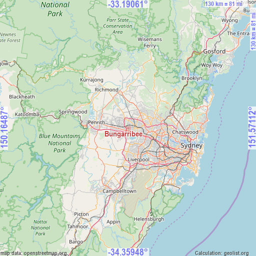
| Upper-left | -33.19061°, | 150.16487° |
| Center: | -33.77704°, | 150.86799° |
| Lower-right: | -34.35948°, | 151.57112° |
| Map W x H: | 130×130 km | = 80.8×80.8mi |
| max Lat: | -10.58257° ⇑51.2% North |
| Bungarribee: | -33.77704° |
| min Lat: | ⇓48.8% South -43.31423° |
| min Long | Bungarribee | max Long |
| 113.53327° | 150.86799° | 153.61246° |
| W 64.6%⇐ | ⇒35.4% E |
Elevation
Elevation of Bungarribee is 40 m = 131 ft, and this is 82 m = 269 ft below average elevation for this country.
| Max E: |
1715 m = 5627 ft | 53.7% |
| Avg. | 122 m = 400 ft | |
| Bungarribee | 40 m = 131 ft | |
Min E: |
-2 m = -7 ft | 46.3% |
See also: Australia elevation on elevation.city.
Geographical zone
Bungarribee is located in South temperate zone (between Tropic of Capricorn and the Antarctic Circle). Distance of this Southern Tropic circle is 1149.7 km =714.4 mi to North.| Distance of | km | miles | from Bungarribee |
|---|---|---|---|
| Equator | 3755.7 | 2333.7 | to North |
| Tropic Capricorn | 1149.7 | 714.4 | to North |
| Antarctic Circle | 3645.5 | 2265.2 | to South |
| South Pole | 6251.4 | 3884.4 | to South |


Nearby cities:
15 places around Bungarribee: (largest is in red/bold)
• Blacktown
4.6 km =2.9 mi,  75°
75°
• Dean Park
4.7 km =2.9 mi,  350°
350°
• Doonside
1.2 km =0.7 mi, 353°
• Eastern Creek
3.3 km =2.1 mi,  190°
190°
• Glendenning
3.4 km =2.1 mi,  338°
338°
• Kings Park
5.3 km =3.3 mi,  44°
44°
• Marayong
3.9 km =2.4 mi, 35°
• Minchinbury
3.7 km =2.3 mi,  252°
252°
• Mount Druitt
4.9 km =3 mi,  283°
283°
• Oakhurst
5.1 km =3.2 mi,  327°
327°
• Plumpton
4 km =2.5 mi,  314°
314°
• Prospect
5 km =3.1 mi,  122°
122°
• Quakers Hill
5.1 km =3.2 mi,  16°
16°
• Rooty Hill
3.4 km =2.1 mi,  289°
289°
• Woodcroft
2.6 km =1.6 mi,  27°
27°
Sources, notices
• [Note1] Compared only with cities in Australia existing in our database
• [Src1] Map data: © OpenStreetMap contributors (CC-BY-SA)
• [Src2] Other city data from geonames.org with taken over terms of usage.
• [Src3] Geographical zone / Annual Mean Temperature by Robert A. Rohde @ Wikipedia
