Velagići geodata
Velagići (Federation of B&H) is a populated locality; located in Bosnia and Herzegovina in Europe/Sarajevo (GMT+2) time zone. With population of 4,972 people, there are 117 cities with bigger population in this country. Compared to other cities in Bosnia and Herzegovina, 57.4% of cities are located further ↓South; 84.9% of cities are located further →East and 61.5% of cities have lower elevation than Velagići. Note1


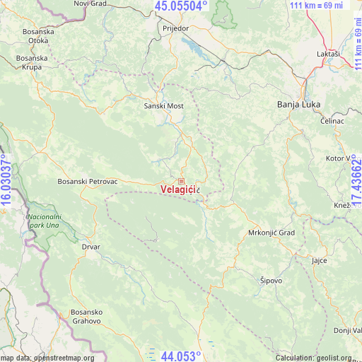
Velagići GPS coordinates[2]
44° 33' 22.248" North, 16° 44' 0.564" East
| Map corner | latitude | longitude |
|---|---|---|
| Upper-left | 45.05504°, | 16.03037° |
| Center: | 44.55618°, | 16.73349° |
| Lower-right: | 44.053°, | 17.43662° |
| Map W x H: | 111.4×111.4 km | = 69.2×69.2mi |
| max Lat: | 45.21956° ⇑42.6% North |
| Velagići: | 44.55618° |
| min Lat: | ⇓57.4% South 42.71197° |
| min Long | Velagići | max Long |
| 15.77806° | 16.73349° | 19.36719° |
| W 15.1%⇐ | ⇒84.9% E |
Elevation
Elevation of Velagići is 350 m = 1148 ft, and this is 9.5 m = 31 ft below average elevation for this country.
| Max E: |
1175 m = 3855 ft | 38.5% |
| Avg. | 359.5 m = 1179 ft | |
| Velagići | 350 m = 1148 ft | |
Min E: |
17 m = 56 ft | 61.5% |
See also: Bosnia and Herzegovina elevation on elevation.city.
Geographical zone
Velagići is located in North temperate zone (between Tropic of Cancer and the Arctic Circle). Distance of this Northern Tropic circle is 2348.3 km =1459.2 mi to South.| Distance of | km | miles | from Velagići |
|---|---|---|---|
| North Pole | 5052.9 | 3139.7 | to North |
| Arctic Circle | 2447 | 1520.5 | to North |
| Tropic Cancer | 2348.3 | 1459.2 | to South |
| Equator | 4954.2 | 3078.4 | to South |


Nearby cities:
15 places around Velagići: (largest is in red/bold)
• Bosanski Petrovac
28.9 km =18 mi,  269°
269°
• Bronzani Majdan
30.9 km =19.2 mi,  31°
31°
• Drinić
21.8 km =13.5 mi,  255°
255°
• Drvar
34.6 km =21.5 mi,  234°
234°
• Gornji Ribnik
16.8 km =10.4 mi,  156°
156°
• Ključ
4.3 km =2.7 mi,  127°
127°
• Krupa na Vrbasu
33.2 km =20.6 mi,  77°
77°
• Marićka
36 km =22.4 mi,  15°
15°
• Mrkonjić Grad
31.7 km =19.7 mi,  119°
119°
• Oštra Luka
34.3 km =21.3 mi,  350°
350°
• Peći
9.2 km =5.7 mi, 24°
• Podbrdo
25.7 km =16 mi, 119°
• Potoci
20.3 km =12.6 mi,  206°
206°
• Sanica
9.7 km =6 mi,  310°
310°
• Sanski Most
24 km =14.9 mi, 347°
Sources, notices
• [Note1] Compared only with cities in Bosnia and Herzegovina existing in our database
• [Src1] Map data: © OpenStreetMap contributors (CC-BY-SA)
• [Src2] Other city data from geonames.org with taken over terms of usage.
• [Src3] Geographical zone / Annual Mean Temperature by Robert A. Rohde @ Wikipedia
