Ključ geodata
Ključ (Federation of B&H) is a seat of a third-order administrative division; located in Bosnia and Herzegovina in Europe/Sarajevo (GMT+2) time zone. With population of 7,245 people, there are 64 cities with bigger population in this country. Compared to other cities in Bosnia and Herzegovina, 54.3% of cities are located further ↓South; 84.5% of cities are located further →East and 56.6% of cities have higher elevation than Ključ. Note1


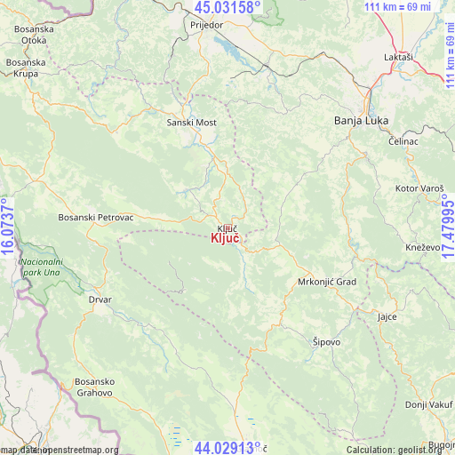
Ključ GPS coordinates[2]
44° 31' 57.036" North, 16° 46' 36.552" East
| Map corner | latitude | longitude |
|---|---|---|
| Upper-left | 45.03158°, | 16.0737° |
| Center: | 44.53251°, | 16.77682° |
| Lower-right: | 44.02913°, | 17.47995° |
| Map W x H: | 111.5×111.5 km | = 69.3×69.3mi |
| max Lat: | 45.21956° ⇑45.7% North |
| Ključ: | 44.53251° |
| min Lat: | ⇓54.3% South 42.71197° |
| min Long | Ključ | max Long |
| 15.77806° | 16.77682° | 19.36719° |
| W 15.5%⇐ | ⇒84.5% E |
Elevation
Elevation of Ključ is 258 m = 846 ft, and this is 101.5 m = 333 ft below average elevation for this country.
| Max E: |
1175 m = 3855 ft | 56.6% |
| Avg. | 359.5 m = 1179 ft | |
| Ključ | 258 m = 846 ft | |
Min E: |
17 m = 56 ft | 43.4% |
See also: Bosnia and Herzegovina elevation on elevation.city.
Geographical zone
Ključ is located in North temperate zone (between Tropic of Cancer and the Arctic Circle). Distance of this Northern Tropic circle is 2345.6 km =1457.5 mi to South.| Distance of | km | miles | from Ključ |
|---|---|---|---|
| North Pole | 5055.5 | 3141.3 | to North |
| Arctic Circle | 2449.6 | 1522.1 | to North |
| Tropic Cancer | 2345.6 | 1457.5 | to South |
| Equator | 4951.6 | 3076.8 | to South |


Nearby cities:
15 places around Ključ: (largest is in red/bold)
• Bosanski Petrovac
32.4 km =20.1 mi,  274°
274°
• Bronzani Majdan
31.7 km =19.7 mi,  24°
24°
• Drinić
24.7 km =15.3 mi,  263°
263°
• Drvar
36 km =22.4 mi,  240°
240°
• Gornji Ribnik
13.2 km =8.2 mi,  166°
166°
• Jezero
37.2 km =23.1 mi,  123°
123°
• Krupa na Vrbasu
30.6 km =19 mi,  71°
71°
• Mrkonjić Grad
27.5 km =17.1 mi, 117°
• Peći
11 km =6.8 mi,  2°
2°
• Podbrdo
21.4 km =13.3 mi, 118°
• Potoci
19.9 km =12.4 mi,  218°
218°
• Sanica
14.1 km =8.8 mi,  309°
309°
• Sanski Most
27.5 km =17.1 mi,  341°
341°
• Velagići
4.3 km =2.7 mi, 307°
• Šipovo
37.1 km =23.1 mi,  138°
138°
Sources, notices
• [Note1] Compared only with cities in Bosnia and Herzegovina existing in our database
• [Src1] Map data: © OpenStreetMap contributors (CC-BY-SA)
• [Src2] Other city data from geonames.org with taken over terms of usage.
• [Src3] Geographical zone / Annual Mean Temperature by Robert A. Rohde @ Wikipedia
