Checker Hall geodata
Checker Hall (Saint Lucy) is a seat of a first-order administrative division; located in Barbados in America/Barbados (GMT-4) time zone. In our database, there are 10 cities with bigger population. Compared to other cities in Barbados, 91.7% of cities are located further ↓South; 91.7% of cities are located further →East and 58.3% of cities have lower elevation than Checker Hall. Note1


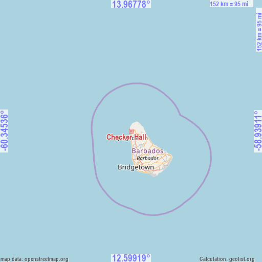
Checker Hall GPS coordinates[2]
13° 17' 4.02" North, 59° 38' 32.028" West
| Map corner | latitude | longitude |
|---|---|---|
| Upper-left | 13.96778°, | -60.34536° |
| Center: | 13.28445°, | -59.64223° |
| Lower-right: | 12.59919°, | -58.93911° |
| Map W x H: | 152.2×152.2 km | = 94.6×94.6mi |
| max Lat: | 13.3196° ⇑8.3% North |
| Checker Hall: | 13.28445° |
| min Lat: | ⇓91.7% South 13.07067° |
| min Long | Checker Hall | max Long |
| -59.64396° | -59.64223° | -59.44861° |
| W 8.3%⇐ | ⇒91.7% E |
Elevation
Elevation of Checker Hall is 52 m = 171 ft, and this is 52.6 m = 173 ft below average elevation for this country.
| Max E: |
302 m = 991 ft | 41.7% |
| Avg. | 104.6 m = 343 ft | |
| Checker Hall | 52 m = 171 ft | |
Min E: |
-1 m = -3 ft | 58.3% |
See also: Barbados elevation on elevation.city.
Geographical zone
Checker Hall is located in North Torrid zone (between Equator and Tropic of Cancer). Distance of this Northern Tropic circle is 1128.8 km =701.4 mi to North.| Distance of | km | miles | from Checker Hall |
|---|---|---|---|
| North Pole | 8530 | 5300.3 | to North |
| Arctic Circle | 5924.1 | 3681.1 | to North |
| Tropic Cancer | 1128.8 | 701.4 | to North |
| Equator | 1477.1 | 917.8 | to South |


Nearby cities:
12 places around Checker Hall: (largest is in red/bold)
• Bathsheba
15 km =9.3 mi,  122°
122°
• Blackmans
15.3 km =9.5 mi,  136°
136°
• Bridgetown
19.8 km =12.3 mi,  173°
173°
• Crab Hill
3.9 km =2.4 mi,  6°
6°
• Crane
28.9 km =18 mi,  133°
133°
• Four Cross Roads
18.2 km =11.3 mi, 134°
• Greenland
7.6 km =4.7 mi,  112°
112°
• Hillaby
9.9 km =6.2 mi, 143°
• Holetown
10.9 km =6.8 mi,  177°
177°
• Oistins
25.9 km =16.1 mi,  156°
156°
• Speightstown
3.8 km =2.4 mi, 182°
• Welchman Hall
13 km =8.1 mi,  146°
146°
Sources, notices
• [Note1] Compared only with cities in Barbados existing in our database
• [Src1] Map data: © OpenStreetMap contributors (CC-BY-SA)
• [Src2] Other city data from geonames.org with taken over terms of usage.
• [Src3] Geographical zone / Annual Mean Temperature by Robert A. Rohde @ Wikipedia
