Blackmans geodata
Blackmans (Saint Joseph) is a populated place; located in Barbados in America/Barbados (GMT-4) time zone. With population of 623 people, there are 7 cities with bigger population in this country. Compared to other cities in Barbados, 66.7% of cities are located further ↑North; 75% of cities are located further ←West and 83.3% of cities have lower elevation than Blackmans. Note1


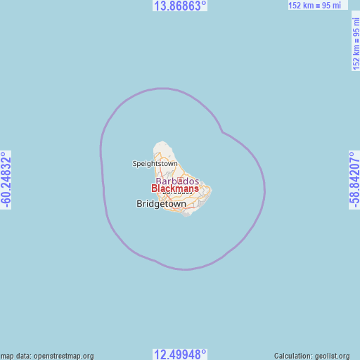
Blackmans GPS coordinates[2]
13° 11' 6.036" North, 59° 32' 42.684" West
| Map corner | latitude | longitude |
|---|---|---|
| Upper-left | 13.86863°, | -60.24832° |
| Center: | 13.18501°, | -59.54519° |
| Lower-right: | 12.49948°, | -58.84207° |
| Map W x H: | 152.2×152.2 km | = 94.6×94.6mi |
| max Lat: | 13.3196° ⇑66.7% North |
| Blackmans: | 13.18501° |
| min Lat: | ⇓33.3% South 13.07067° |
| min Long | Blackmans | max Long |
| -59.64396° | -59.54519° | -59.44861° |
| W 75%⇐ | ⇒25% E |
Elevation
Elevation of Blackmans is 279 m = 915 ft, and this is 174.4 m = 572 ft above average elevation for this country.
| Max E: |
302 m = 991 ft | 16.7% |
| Blackmans | 279 m 915 ft | |
| Avg. | 104.6 m = 343 ft | |
Min E: |
-1 m = -3 ft | 83.3% |
See also: Barbados elevation on elevation.city.
Geographical zone
Blackmans is located in North Torrid zone (between Equator and Tropic of Cancer). Distance of this Northern Tropic circle is 1139.9 km =708.3 mi to North.| Distance of | km | miles | from Blackmans |
|---|---|---|---|
| North Pole | 8541 | 5307.1 | to North |
| Arctic Circle | 5935.1 | 3687.9 | to North |
| Tropic Cancer | 1139.9 | 708.3 | to North |
| Equator | 1466 | 910.9 | to South |


Nearby cities:
12 places around Blackmans: (largest is in red/bold)
• Bathsheba
3.6 km =2.2 mi,  35°
35°
• Bridgetown
11.9 km =7.4 mi,  223°
223°
• Checker Hall
15.3 km =9.5 mi,  316°
316°
• Crab Hill
18 km =11.2 mi,  326°
326°
• Crane
13.7 km =8.5 mi,  130°
130°
• Four Cross Roads
3 km =1.9 mi,  123°
123°
• Greenland
8.9 km =5.5 mi,  336°
336°
• Hillaby
5.6 km =3.5 mi,  303°
303°
• Holetown
10.1 km =6.3 mi,  271°
271°
• Oistins
12.7 km =7.9 mi,  180°
180°
• Speightstown
12.9 km =8 mi, 304°
• Welchman Hall
3.4 km =2.1 mi, 273°
Sources, notices
• [Note1] Compared only with cities in Barbados existing in our database
• [Src1] Map data: © OpenStreetMap contributors (CC-BY-SA)
• [Src2] Other city data from geonames.org with taken over terms of usage.
• [Src3] Geographical zone / Annual Mean Temperature by Robert A. Rohde @ Wikipedia
