Kozloduy geodata
Kozloduy (Vratsa) is a seat of a second-order administrative division; located in Bulgaria in Europe/Sofia (GMT+3) time zone. With population of 14,717 people, there are 57 cities with bigger population in this country. Compared to other cities in Bulgaria, 93% of cities are located further ↓South; 77% of cities are located further →East and 89% of cities have higher elevation than Kozloduy. Note1


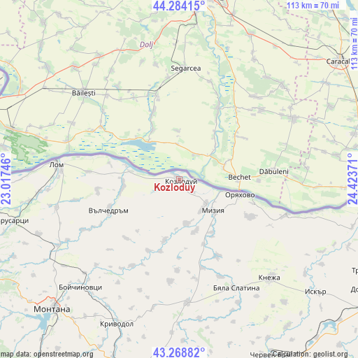
Kozloduy GPS coordinates[2]
43° 46' 43.104" North, 23° 43' 14.088" East
| Map corner | latitude | longitude |
|---|---|---|
| Upper-left | 44.28415°, | 23.01746° |
| Center: | 43.77864°, | 23.72058° |
| Lower-right: | 43.26882°, | 24.42371° |
| Map W x H: | 112.9×112.9 km | = 70.2×70.2mi |
| max Lat: | 44.16214° ⇑7% North |
| Kozloduy: | 43.77864° |
| min Lat: | ⇓93% South 41.32715° |
| min Long | Kozloduy | max Long |
| 22.52139° | 23.72058° | 28.53429° |
| W 23%⇐ | ⇒77% E |
Elevation
Elevation of Kozloduy is 41 m = 135 ft, and this is 275.6 m = 904 ft below average elevation for this country.
| Max E: |
1221 m = 4006 ft | 89% |
| Avg. | 316.6 m = 1039 ft | |
| Kozloduy | 41 m = 135 ft | |
Min E: |
1 m = 3 ft | 11% |
See also: Bulgaria elevation on elevation.city.
Geographical zone
Kozloduy is located in North temperate zone (between Tropic of Cancer and the Arctic Circle). Distance of this Northern Tropic circle is 2261.8 km =1405.4 mi to South.| Distance of | km | miles | from Kozloduy |
|---|---|---|---|
| North Pole | 5139.3 | 3193.4 | to North |
| Arctic Circle | 2533.4 | 1574.2 | to North |
| Tropic Cancer | 2261.8 | 1405.4 | to South |
| Equator | 4867.7 | 3024.6 | to South |


Nearby cities:
15 places around Kozloduy: (largest is in red/bold)
• Borovan
38.5 km =23.9 mi,  176°
176°
• Boychinovtsi
46 km =28.6 mi,  222°
222°
• Brusartsi
54.1 km =33.6 mi,  255°
255°
• Byala Slatina
38.7 km =24 mi,  153°
153°
• Hayredin
20.2 km =12.6 mi,  193°
193°
• Iskar
57.2 km =35.5 mi,  129°
129°
• Knezha
42.6 km =26.5 mi,  136°
136°
• Krivodol
48.8 km =30.3 mi,  202°
202°
• Lom
39.1 km =24.3 mi,  276°
276°
• Medkovets
47.6 km =29.6 mi,  248°
248°
• Mizia
14.8 km =9.2 mi, 133°
• Montana
57 km =35.4 mi, 224°
• Oryahovo
19.8 km =12.3 mi,  103°
103°
• Valchedram
24.1 km =15 mi, 246°
• Yakimovo
33.6 km =20.9 mi,  241°
241°
Sources, notices
• [Note1] Compared only with cities in Bulgaria existing in our database
• [Src1] Map data: © OpenStreetMap contributors (CC-BY-SA)
• [Src2] Other city data from geonames.org with taken over terms of usage.
• [Src3] Geographical zone / Annual Mean Temperature by Robert A. Rohde @ Wikipedia
