Passira geodata
Passira (Pernambuco) is a populated place; located in Brazil in America/Recife (GMT-3) time zone. With population of 12,664 people, there are 1402 cities with bigger population in this country. Compared to other cities in Brazil, 75.1% of cities are located further ↓South; 95.4% of cities are located further ←West and 62.6% of cities have higher elevation than Passira. Note1


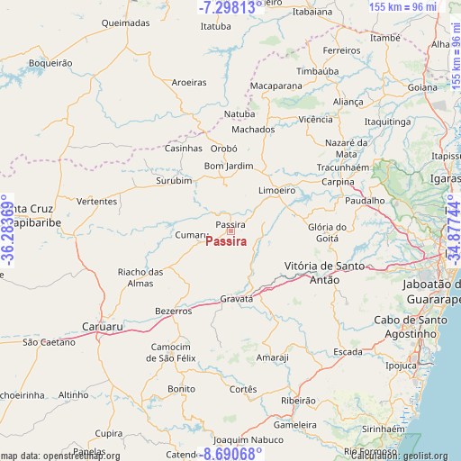
Passira GPS coordinates[2]
7° 59' 42" South, 35° 34' 50.016" West
| Map corner | latitude | longitude |
|---|---|---|
| Upper-left | -7.29813°, | -36.28369° |
| Center: | -7.995°, | -35.58056° |
| Lower-right: | -8.69068°, | -34.87744° |
| Map W x H: | 154.8×154.8 km | = 96.2×96.2mi |
| max Lat: | 2.81972° ⇑24.9% North |
| Passira: | -7.995° |
| min Lat: | ⇓75.1% South -33.69111° |
| min Long | Passira | max Long |
| -72.89583° | -35.58056° | -32.41083° |
| W 95.4%⇐ | ⇒4.6% E |
Elevation
Elevation of Passira is 188 m = 617 ft, and this is 192.9 m = 633 ft below average elevation for this country.
| Max E: |
1603 m = 5259 ft | 62.6% |
| Avg. | 380.9 m = 1250 ft | |
| Passira | 188 m = 617 ft | |
Min E: |
0 m = 0 ft | 37.4% |
See also: Brazil elevation on elevation.city.
Geographical zone
Passira is located in South Torrid zone (between Equator and Tropic of Capricorn). Distance of Equator is 889 km =552.4 mi to North.| Distance of | km | miles | from Passira |
|---|---|---|---|
| Equator | 889 | 552.4 | to North |
| Tropic Capricorn | 1717 | 1066.9 | to South |
| Antarctic Circle | 6512.2 | 4046.5 | to South |
| South Pole | 9118.1 | 5665.7 | to South |


Nearby cities:
15 places around Passira: (largest is in red/bold)
• Bezerros
35.6 km =22.1 mi,  221°
221°
• Bom Jardim
22.2 km =13.8 mi,  358°
358°
• Chã Grande
30.1 km =18.7 mi,  154°
154°
• Cumaru
12.9 km =8 mi,  264°
264°
• Feira Nova
21.6 km =13.4 mi,  76°
76°
• Glória do Goitá
31.7 km =19.7 mi,  91°
91°
• Gravatá
23 km =14.3 mi,  175°
175°
• João Alfredo
15.5 km =9.6 mi, 356°
• Lagoa do Itaenga
32.6 km =20.3 mi, 78°
• Limoeiro
19.6 km =12.2 mi,  47°
47°
• Orobó
27.9 km =17.3 mi, 355°
• Pombos
26 km =16.2 mi,  128°
128°
• Surubim
26.3 km =16.3 mi,  313°
313°
• Umbuzeiro
34.5 km =21.4 mi,  344°
344°
• Vitória de Santo Antão
34.7 km =21.6 mi,  113°
113°
Sources, notices
• [Note1] Compared only with cities in Brazil existing in our database
• [Src1] Map data: © OpenStreetMap contributors (CC-BY-SA)
• [Src2] Other city data from geonames.org with taken over terms of usage.
• [Src3] Geographical zone / Annual Mean Temperature by Robert A. Rohde @ Wikipedia
