Matriz de Camaragibe geodata
Matriz de Camaragibe (Alagoas) is a populated place; located in Brazil in America/Maceio (GMT-3) time zone. With population of 18,705 people, there are 999 cities with bigger population in this country. Compared to other cities in Brazil, 70.8% of cities are located further ↓South; 95.7% of cities are located further ←West and 94.3% of cities have higher elevation than Matriz de Camaragibe. Note1


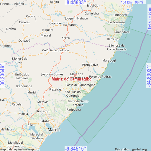
Matriz de Camaragibe GPS coordinates[2]
9° 9' 6.012" South, 35° 31' 59.988" West
| Map corner | latitude | longitude |
|---|---|---|
| Upper-left | -8.45683°, | -36.23646° |
| Center: | -9.15167°, | -35.53333° |
| Lower-right: | -9.84515°, | -34.83021° |
| Map W x H: | 154.4×154.4 km | = 95.9×95.9mi |
| max Lat: | 2.81972° ⇑29.2% North |
| Matriz de Camaragibe: | -9.15167° |
| min Lat: | ⇓70.8% South -33.69111° |
| min Long | Matriz de Camar | max Long |
| -72.89583° | -35.53333° | -32.41083° |
| W 95.7%⇐ | ⇒4.3% E |
Elevation
Elevation of Matriz de Camaragibe is 10 m = 33 ft, and this is 370.9 m = 1217 ft below average elevation for this country.
| Max E: |
1603 m = 5259 ft | 94.3% |
| Avg. | 380.9 m = 1250 ft | |
| Matriz de Camaragibe | 10 m = 33 ft | |
Min E: |
0 m = 0 ft | 5.7% |
See also: Brazil elevation on elevation.city.
Geographical zone
Matriz de Camaragibe is located in South Torrid zone (between Equator and Tropic of Capricorn). Distance of Equator is 1017.6 km =632.3 mi to North.| Distance of | km | miles | from Matriz de Camaragibe |
|---|---|---|---|
| Equator | 1017.6 | 632.3 | to North |
| Tropic Capricorn | 1588.3 | 986.9 | to South |
| Antarctic Circle | 6383.6 | 3966.6 | to South |
| South Pole | 8989.5 | 5585.8 | to South |


Nearby cities:
15 places around Matriz de Camaragibe: (largest is in red/bold)
• Barra de Santo Antônio
28.3 km =17.6 mi,  174°
174°
• Colônia Leopoldina
34.2 km =21.3 mi,  322°
322°
• Flexeiras
27.6 km =17.1 mi,  259°
259°
• Ibateguara
48.8 km =30.3 mi,  294°
294°
• Jundiá
24.5 km =15.2 mi,  349°
349°
• Maragogi
37.5 km =23.3 mi,  65°
65°
• Maraial
51 km =31.7 mi, 323°
• Messias
42.5 km =26.4 mi,  232°
232°
• Murici
48.2 km =30 mi,  249°
249°
• Novo Lino
29.1 km =18.1 mi,  334°
334°
• Porto Calvo
19 km =11.8 mi,  51°
51°
• Rio Largo
50.5 km =31.4 mi,  224°
224°
• São José da Coroa Grande
50.9 km =31.6 mi,  56°
56°
• São Luís do Quitunde
18.8 km =11.7 mi,  189°
189°
• Água Preta
49.4 km =30.7 mi,  0°
0°
Sources, notices
• [Note1] Compared only with cities in Brazil existing in our database
• [Src1] Map data: © OpenStreetMap contributors (CC-BY-SA)
• [Src2] Other city data from geonames.org with taken over terms of usage.
• [Src3] Geographical zone / Annual Mean Temperature by Robert A. Rohde @ Wikipedia
