Igaci geodata
Igaci (Alagoas) is a populated place; located in Brazil in America/Maceio (GMT-3) time zone. With population of 6,480 people, there are 1857 cities with bigger population in this country. Compared to other cities in Brazil, 69.3% of cities are located further ↓South; 90.3% of cities are located further ←West and 56.5% of cities have higher elevation than Igaci. Note1


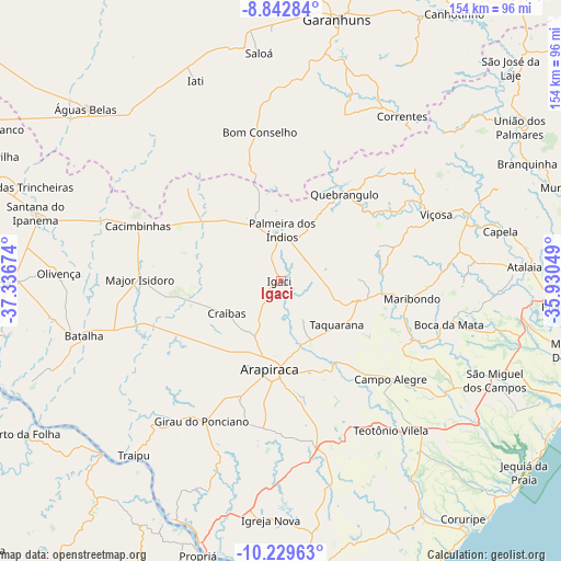
Igaci GPS coordinates[2]
9° 32' 12.984" South, 36° 38' 0.996" West
| Map corner | latitude | longitude |
|---|---|---|
| Upper-left | -8.84284°, | -37.33674° |
| Center: | -9.53694°, | -36.63361° |
| Lower-right: | -10.22963°, | -35.93049° |
| Map W x H: | 154.2×154.2 km | = 95.8×95.8mi |
| max Lat: | 2.81972° ⇑30.7% North |
| Igaci: | -9.53694° |
| min Lat: | ⇓69.3% South -33.69111° |
| min Long | Igaci | max Long |
| -72.89583° | -36.63361° | -32.41083° |
| W 90.3%⇐ | ⇒9.7% E |
Elevation
Elevation of Igaci is 250 m = 820 ft, and this is 130.9 m = 429 ft below average elevation for this country.
| Max E: |
1603 m = 5259 ft | 56.5% |
| Avg. | 380.9 m = 1250 ft | |
| Igaci | 250 m = 820 ft | |
Min E: |
0 m = 0 ft | 43.5% |
See also: Brazil elevation on elevation.city.
Geographical zone
Igaci is located in South Torrid zone (between Equator and Tropic of Capricorn). Distance of Equator is 1060.4 km =658.9 mi to North.| Distance of | km | miles | from Igaci |
|---|---|---|---|
| Equator | 1060.4 | 658.9 | to North |
| Tropic Capricorn | 1545.5 | 960.3 | to South |
| Antarctic Circle | 6340.8 | 3940 | to South |
| South Pole | 8946.7 | 5559.2 | to South |


Nearby cities:
15 places around Igaci: (largest is in red/bold)
• Anadia
39.7 km =24.7 mi,  114°
114°
• Arapiraca
24.2 km =15 mi,  187°
187°
• Bom Conselho
41.1 km =25.5 mi,  352°
352°
• Cacimbinhas
42 km =26.1 mi,  291°
291°
• Cajueiro
28.4 km =17.6 mi,  134°
134°
• Campo Alegre
41.3 km =25.7 mi, 131°
• Coité do Nóia
12.2 km =7.6 mi,  150°
150°
• Girau do Ponciano
44.1 km =27.4 mi,  209°
209°
• Lagoa da Canoa
34.5 km =21.4 mi,  199°
199°
• Limoeiro de Anadia
26.8 km =16.7 mi, 147°
• Major Isidoro
38.5 km =23.9 mi,  270°
270°
• Maribondo
36.3 km =22.6 mi,  97°
97°
• Minador do Negrão
36.1 km =22.4 mi,  315°
315°
• Quebrangulo
30.1 km =18.7 mi,  36°
36°
• Taquarana
19.2 km =11.9 mi, 128°
Sources, notices
• [Note1] Compared only with cities in Brazil existing in our database
• [Src1] Map data: © OpenStreetMap contributors (CC-BY-SA)
• [Src2] Other city data from geonames.org with taken over terms of usage.
• [Src3] Geographical zone / Annual Mean Temperature by Robert A. Rohde @ Wikipedia
