Orleans geodata
Orleans (Santa Catarina) is a populated place; located in Brazil in America/Sao_Paulo (GMT-3) time zone. With population of 16,422 people, there are 1127 cities with bigger population in this country. Compared to other cities in Brazil, 94.6% of cities are located further ↑North; 73.9% of cities are located further →East and 69.2% of cities have higher elevation than Orleans. Note1


Orleans GPS coordinates[2]
28° 21' 32.004" South, 49° 17' 29.004" West
| Map corner | latitude | longitude |
|---|---|---|
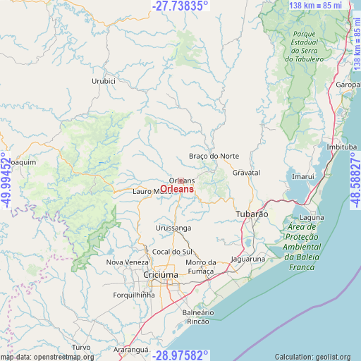
| Upper-left | -27.73835°, | -49.99452° |
| Center: | -28.35889°, | -49.29139° |
| Lower-right: | -28.97582°, | -48.58827° |
| Map W x H: | 137.6×137.6 km | = 85.5×85.5mi |
| max Lat: | 2.81972° ⇑94.6% North |
| Orleans: | -28.35889° |
| min Lat: | ⇓5.4% South -33.69111° |
| min Long | Orleans | max Long |
| -72.89583° | -49.29139° | -32.41083° |
| W 26.1%⇐ | ⇒73.9% E |
Elevation
Elevation of Orleans is 131 m = 430 ft, and this is 249.9 m = 820 ft below average elevation for this country.
| Max E: |
1603 m = 5259 ft | 69.2% |
| Avg. | 380.9 m = 1250 ft | |
| Orleans | 131 m = 430 ft | |
Min E: |
0 m = 0 ft | 30.8% |
See also: Brazil elevation on elevation.city.
Geographical zone
Orleans is located in South temperate zone (between Tropic of Capricorn and the Antarctic Circle). Distance of this Southern Tropic circle is 547.3 km =340.1 mi to North.| Distance of | km | miles | from Orleans |
|---|---|---|---|
| Equator | 3153.2 | 1959.3 | to North |
| Tropic Capricorn | 547.3 | 340.1 | to North |
| Antarctic Circle | 4248 | 2639.6 | to South |
| South Pole | 6853.8 | 4258.8 | to South |


Nearby cities:
15 places around Orleans: (largest is in red/bold)
• Anitápolis
53.3 km =33.1 mi,  17°
17°
• Braço do Norte
15.5 km =9.6 mi,  52°
52°
• Cocal
27.4 km =17 mi,  187°
187°
• Criciúma
36.2 km =22.5 mi, 192°
• Forquilhinha
46.7 km =29 mi,  202°
202°
• Imbituba
62.2 km =38.6 mi,  77°
77°
• Içara
39.4 km =24.5 mi,  181°
181°
• Jaguaruna
39.1 km =24.3 mi,  138°
138°
• Laguna
51.8 km =32.2 mi,  105°
105°
• Lauro Muller
11 km =6.8 mi,  249°
249°
• Morro da Fumaça
33.4 km =20.8 mi,  166°
166°
• Siderópolis
29.6 km =18.4 mi,  206°
206°
• São José
20.6 km =12.8 mi,  37°
37°
• Tubarão
30.3 km =18.8 mi, 113°
• Urussanga
17.9 km =11.1 mi, 189°
Sources, notices
• [Note1] Compared only with cities in Brazil existing in our database
• [Src1] Map data: © OpenStreetMap contributors (CC-BY-SA)
• [Src2] Other city data from geonames.org with taken over terms of usage.
• [Src3] Geographical zone / Annual Mean Temperature by Robert A. Rohde @ Wikipedia
