Lapão geodata
Lapão (Bahia) is a populated place; located in Brazil in America/Bahia (GMT-3) time zone. With population of 11,252 people, there are 1540 cities with bigger population in this country. Compared to other cities in Brazil, 63.8% of cities are located further ↓South; 66.7% of cities are located further ←West and 87.4% of cities have lower elevation than Lapão. Note1


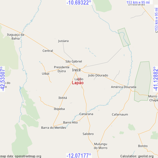
Lapão GPS coordinates[2]
11° 22' 59.988" South, 41° 49' 54.984" West
| Map corner | latitude | longitude |
|---|---|---|
| Upper-left | -10.69322°, | -42.53507° |
| Center: | -11.38333°, | -41.83194° |
| Lower-right: | -12.07177°, | -41.12882° |
| Map W x H: | 153.3×153.3 km | = 95.3×95.3mi |
| max Lat: | 2.81972° ⇑36.2% North |
| Lapão: | -11.38333° |
| min Lat: | ⇓63.8% South -33.69111° |
| min Long | Lapão | max Long |
| -72.89583° | -41.83194° | -32.41083° |
| W 66.7%⇐ | ⇒33.3% E |
Elevation
Elevation of Lapão is 775 m = 2543 ft, and this is 394.1 m = 1293 ft above average elevation for this country.
| Max E: |
1603 m = 5259 ft | 12.6% |
| Lapão | 775 m 2543 ft | |
| Avg. | 380.9 m = 1250 ft | |
Min E: |
0 m = 0 ft | 87.4% |
See also: Brazil elevation on elevation.city.
Geographical zone
Lapão is located in South Torrid zone (between Equator and Tropic of Capricorn). Distance of Equator is 1265.7 km =786.5 mi to North.| Distance of | km | miles | from Lapão |
|---|---|---|---|
| Equator | 1265.7 | 786.5 | to North |
| Tropic Capricorn | 1340.2 | 832.8 | to South |
| Antarctic Circle | 6135.5 | 3812.4 | to South |
| South Pole | 8741.4 | 5431.7 | to South |


Nearby cities:
15 places around Lapão: (largest is in red/bold)
• América Dourada
43.9 km =27.3 mi,  100°
100°
• Barro Alto
42.9 km =26.7 mi,  191°
191°
• Beira Rio
139.6 km =86.7 mi,  226°
226°
• Cafarnaum
52.5 km =32.6 mi,  131°
131°
• Canarana
34.2 km =21.3 mi,  168°
168°
• Ibipeba
34.7 km =21.6 mi,  214°
214°
• Iraquara
99 km =61.5 mi, 166°
• Irecê
9.2 km =5.7 mi,  343°
343°
• Jacobina
145.5 km =90.4 mi,  81°
81°
• Miguel Calmon
134.9 km =83.8 mi,  92°
92°
• Morro do Chapéu
75.7 km =47 mi, 104°
• Piritiba
144.3 km =89.7 mi,  105°
105°
• Seabra
115.1 km =71.5 mi,  176°
176°
• Tapiramutá
124.5 km =77.4 mi, 114°
• Xique Xique
115.9 km =72 mi,  302°
302°
Sources, notices
• [Note1] Compared only with cities in Brazil existing in our database
• [Src1] Map data: © OpenStreetMap contributors (CC-BY-SA)
• [Src2] Other city data from geonames.org with taken over terms of usage.
• [Src3] Geographical zone / Annual Mean Temperature by Robert A. Rohde @ Wikipedia
