Iraquara geodata
Iraquara (Bahia) is a populated place; located in Brazil in America/Bahia (GMT-3) time zone. With population of 5,131 people, there are 1908 cities with bigger population in this country. Compared to other cities in Brazil, 61.9% of cities are located further ↓South; 67.7% of cities are located further ←West and 80.7% of cities have lower elevation than Iraquara. Note1


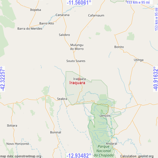
Iraquara GPS coordinates[2]
12° 14' 54.996" South, 41° 37' 9.984" West
| Map corner | latitude | longitude |
|---|---|---|
| Upper-left | -11.56061°, | -42.32257° |
| Center: | -12.24861°, | -41.61944° |
| Lower-right: | -12.93482°, | -40.91632° |
| Map W x H: | 152.8×152.8 km | = 94.9×94.9mi |
| max Lat: | 2.81972° ⇑38.1% North |
| Iraquara: | -12.24861° |
| min Lat: | ⇓61.9% South -33.69111° |
| min Long | Iraquara | max Long |
| -72.89583° | -41.61944° | -32.41083° |
| W 67.7%⇐ | ⇒32.3% E |
Elevation
Elevation of Iraquara is 699 m = 2293 ft, and this is 318.1 m = 1044 ft above average elevation for this country.
| Max E: |
1603 m = 5259 ft | 19.3% |
| Iraquara | 699 m 2293 ft | |
| Avg. | 380.9 m = 1250 ft | |
Min E: |
0 m = 0 ft | 80.7% |
See also: Brazil elevation on elevation.city.
Geographical zone
Iraquara is located in South Torrid zone (between Equator and Tropic of Capricorn). Distance of this Southern Tropic circle is 1244 km =773 mi to South.| Distance of | km | miles | from Iraquara |
|---|---|---|---|
| Equator | 1361.9 | 846.2 | to North |
| Tropic Capricorn | 1244 | 773 | to South |
| Antarctic Circle | 6039.3 | 3752.6 | to South |
| South Pole | 8645.1 | 5371.8 | to South |


Nearby cities:
15 places around Iraquara: (largest is in red/bold)
• América Dourada
90.4 km =56.2 mi,  12°
12°
• Barro Alto
62.9 km =39.1 mi,  329°
329°
• Beira Rio
123.4 km =76.7 mi,  269°
269°
• Cafarnaum
63.9 km =39.7 mi, 14°
• Canarana
64.8 km =40.3 mi,  345°
345°
• Ibipeba
79.9 km =49.6 mi, 327°
• Irecê
108.1 km =67.2 mi, 346°
• Lapão
99 km =61.5 mi, 346°
• Morro do Chapéu
92.6 km =57.5 mi,  32°
32°
• Piritiba
129.3 km =80.3 mi,  63°
63°
• Ruy Barbosa
122.4 km =76.1 mi,  91°
91°
• Seabra
24.9 km =15.5 mi,  221°
221°
• Tapiramutá
100.5 km =62.4 mi, 63°
• Terra Nova
104.3 km =64.8 mi,  97°
97°
• Vera Cruz
76.7 km =47.7 mi,  123°
123°
Sources, notices
• [Note1] Compared only with cities in Brazil existing in our database
• [Src1] Map data: © OpenStreetMap contributors (CC-BY-SA)
• [Src2] Other city data from geonames.org with taken over terms of usage.
• [Src3] Geographical zone / Annual Mean Temperature by Robert A. Rohde @ Wikipedia
