Ibotirama geodata
Ibotirama (Bahia) is a populated place; located in Brazil in America/Bahia (GMT-3) time zone. With population of 17,354 people, there are 1071 cities with bigger population in this country. Compared to other cities in Brazil, 62% of cities are located further ↓South; 59.2% of cities are located further ←West and 55.5% of cities have lower elevation than Ibotirama. Note1


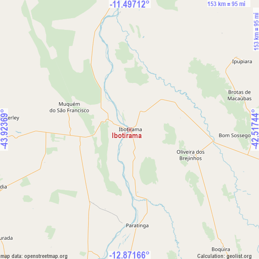
Ibotirama GPS coordinates[2]
12° 11' 7.008" South, 43° 13' 14.016" West
| Map corner | latitude | longitude |
|---|---|---|
| Upper-left | -11.49712°, | -43.92369° |
| Center: | -12.18528°, | -43.22056° |
| Lower-right: | -12.87166°, | -42.51744° |
| Map W x H: | 152.8×152.8 km | = 94.9×94.9mi |
| max Lat: | 2.81972° ⇑38% North |
| Ibotirama: | -12.18528° |
| min Lat: | ⇓62% South -33.69111° |
| min Long | Ibotirama | max Long |
| -72.89583° | -43.22056° | -32.41083° |
| W 59.2%⇐ | ⇒40.8% E |
Elevation
Elevation of Ibotirama is 426 m = 1398 ft, and this is 45.1 m = 148 ft above average elevation for this country.
| Max E: |
1603 m = 5259 ft | 44.5% |
| Ibotirama | 426 m 1398 ft | |
| Avg. | 380.9 m = 1250 ft | |
Min E: |
0 m = 0 ft | 55.5% |
See also: Brazil elevation on elevation.city.
Geographical zone
Ibotirama is located in South Torrid zone (between Equator and Tropic of Capricorn). Distance of this Southern Tropic circle is 1251 km =777.3 mi to South.| Distance of | km | miles | from Ibotirama |
|---|---|---|---|
| Equator | 1354.9 | 841.9 | to North |
| Tropic Capricorn | 1251 | 777.3 | to South |
| Antarctic Circle | 6046.3 | 3757 | to South |
| South Pole | 8652.2 | 5376.2 | to South |


Nearby cities:
15 places around Ibotirama: (largest is in red/bold)
• Barra
122.1 km =75.9 mi,  4°
4°
• Barro Alto
150 km =93.2 mi,  71°
71°
• Beira Rio
51.1 km =31.8 mi,  98°
98°
• Bom Jesus da Lapa
120.9 km =75.1 mi,  190°
190°
• Boquira
88.6 km =55.1 mi,  143°
143°
• Canarana
167.4 km =104 mi, 70°
• Ibipeba
144.8 km =90 mi, 65°
• Iraquara
174.1 km =108.2 mi,  92°
92°
• Macaúbas
108.7 km =67.5 mi,  148°
148°
• Oliveira dos Brejinhos
38.2 km =23.7 mi,  112°
112°
• Paratinga
56.3 km =35 mi,  175°
175°
• Riacho de Santana
161.2 km =100.2 mi,  169°
169°
• Santa Maria da Vitória
170.7 km =106.1 mi,  218°
218°
• Seabra
159.6 km =99.2 mi, 99°
• Xique Xique
160.7 km =99.9 mi,  19°
19°
Sources, notices
• [Note1] Compared only with cities in Brazil existing in our database
• [Src1] Map data: © OpenStreetMap contributors (CC-BY-SA)
• [Src2] Other city data from geonames.org with taken over terms of usage.
• [Src3] Geographical zone / Annual Mean Temperature by Robert A. Rohde @ Wikipedia
