Bom Jesus da Lapa geodata
Bom Jesus da Lapa (Bahia) is a populated place; located in Brazil in America/Bahia (GMT-3) time zone. With population of 40,691 people, there are 521 cities with bigger population in this country. Compared to other cities in Brazil, 59.6% of cities are located further ↓South; 58.4% of cities are located further ←West and 56.7% of cities have lower elevation than Bom Jesus da Lapa. Note1


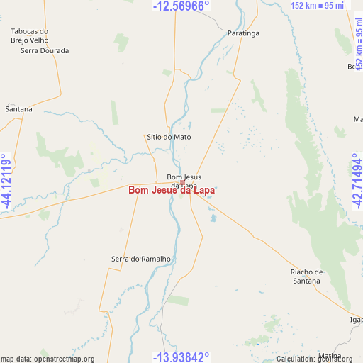
Bom Jesus da Lapa GPS coordinates[2]
13° 15' 18" South, 43° 25' 5.016" West
| Map corner | latitude | longitude |
|---|---|---|
| Upper-left | -12.56966°, | -44.12119° |
| Center: | -13.255°, | -43.41806° |
| Lower-right: | -13.93842°, | -42.71494° |
| Map W x H: | 152.2×152.2 km | = 94.6×94.6mi |
| max Lat: | 2.81972° ⇑40.4% North |
| Bom Jesus da Lapa: | -13.255° |
| min Lat: | ⇓59.6% South -33.69111° |
| min Long | Bom Jesus da La | max Long |
| -72.89583° | -43.41806° | -32.41083° |
| W 58.4%⇐ | ⇒41.6% E |
Elevation
Elevation of Bom Jesus da Lapa is 439 m = 1440 ft, and this is 58.1 m = 191 ft above average elevation for this country.
| Max E: |
1603 m = 5259 ft | 43.3% |
| Bom Jesus da Lapa | 439 m 1440 ft | |
| Avg. | 380.9 m = 1250 ft | |
Min E: |
0 m = 0 ft | 56.7% |
See also: Bom Jesus da Lapa elevation on elevation.city.
Geographical zone
Bom Jesus da Lapa is located in South Torrid zone (between Equator and Tropic of Capricorn). Distance of this Southern Tropic circle is 1132.1 km =703.5 mi to South.| Distance of | km | miles | from Bom Jesus da Lapa |
|---|---|---|---|
| Equator | 1473.8 | 915.8 | to North |
| Tropic Capricorn | 1132.1 | 703.5 | to South |
| Antarctic Circle | 5927.4 | 3683.1 | to South |
| South Pole | 8533.2 | 5302.3 | to South |


Nearby cities:
15 places around Bom Jesus da Lapa: (largest is in red/bold)
• Beira Rio
132.5 km =82.3 mi,  32°
32°
• Boquira
88.6 km =55.1 mi,  57°
57°
• Caetité
136.3 km =84.7 mi,  131°
131°
• Carinhanha
122.6 km =76.2 mi,  197°
197°
• Correntina
132.2 km =82.1 mi,  265°
265°
• Guanambi
127.8 km =79.4 mi,  147°
147°
• Ibotirama
120.9 km =75.1 mi,  10°
10°
• Livramento do Brumado
175.7 km =109.2 mi,  104°
104°
• Macaúbas
82.2 km =51.1 mi,  71°
71°
• Oliveira dos Brejinhos
118.7 km =73.8 mi, 28°
• Palmas de Monte Alto
115.9 km =72 mi,  166°
166°
• Paramirim
129.3 km =80.3 mi, 99°
• Paratinga
67.7 km =42.1 mi,  21°
21°
• Riacho de Santana
65.1 km =40.5 mi, 127°
• Santa Maria da Vitória
85.7 km =53.3 mi,  260°
260°
Sources, notices
• [Note1] Compared only with cities in Brazil existing in our database
• [Src1] Map data: © OpenStreetMap contributors (CC-BY-SA)
• [Src2] Other city data from geonames.org with taken over terms of usage.
• [Src3] Geographical zone / Annual Mean Temperature by Robert A. Rohde @ Wikipedia
