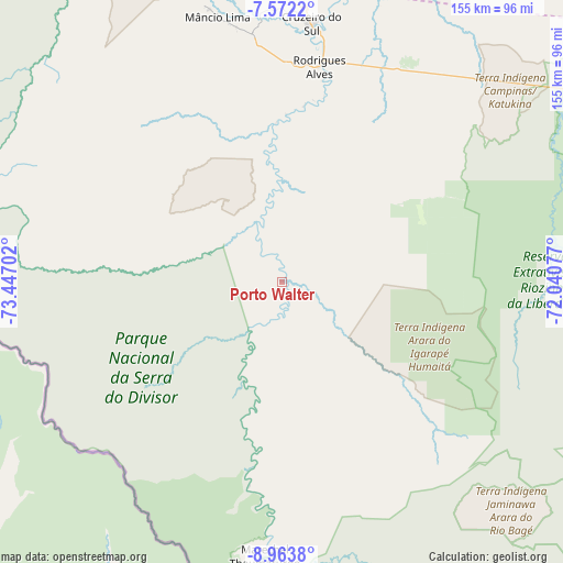
Porto Walter geodata
Porto Walter (Acre) is a populated place; located in Brazil in America/Rio_Branco (GMT-5) time zone. With population of 1,816 people, there are 2009 cities with bigger population in this country. Compared to other cities in Brazil, 73.9% of cities are located further ↓South; 99.9% of cities are located further →East and 61.7% of cities have higher elevation than Porto Walter. Note1


Porto Walter GPS coordinates[2]
8° 16' 6.996" South, 72° 44' 38.004" West
| Map corner | latitude | longitude |
|---|---|---|
| Upper-left | -7.5722°, | -73.44702° |
| Center: | -8.26861°, | -72.74389° |
| Lower-right: | -8.9638°, | -72.04077° |
| Map W x H: | 154.7×154.7 km | = 96.1×96.1mi |
| max Lat: | 2.81972° ⇑26.1% North |
| Porto Walter: | -8.26861° |
| min Lat: | ⇓73.9% South -33.69111° |
| min Long | Porto Walter | max Long |
| -72.89583° | -72.74389° | -32.41083° |
| W 0.1%⇐ | ⇒99.9% E |
Elevation
Elevation of Porto Walter is 195 m = 640 ft, and this is 185.9 m = 610 ft below average elevation for this country.
| Max E: |
1603 m = 5259 ft | 61.7% |
| Avg. | 380.9 m = 1250 ft | |
| Porto Walter | 195 m = 640 ft | |
Min E: |
0 m = 0 ft | 38.3% |
See also: Brazil elevation on elevation.city.
Geographical zone
Porto Walter is located in South Torrid zone (between Equator and Tropic of Capricorn). Distance of Equator is 919.4 km =571.3 mi to North.| Distance of | km | miles | from Porto Walter |
|---|---|---|---|
| Equator | 919.4 | 571.3 | to North |
| Tropic Capricorn | 1686.5 | 1047.9 | to South |
| Antarctic Circle | 6481.8 | 4027.6 | to South |
| South Pole | 9087.7 | 5646.8 | to South |


Nearby cities:
8 places around Porto Walter: (largest is in red/bold)
• Cruzeiro do Sul
71.6 km =44.5 mi,  5°
5°
• Eirunepé
363.5 km =225.9 mi,  60°
60°
• Envira
298.5 km =185.5 mi,  68°
68°
• Feijó
263.2 km =163.5 mi,  87°
87°
• Manoel Urbano
388.3 km =241.3 mi,  99°
99°
• Marechal Thaumaturgo
75 km =46.6 mi,  184°
184°
• Mâncio Lima
74.7 km =46.4 mi,  347°
347°
• Tarauacá
218 km =135.5 mi, 86°
Sources, notices
• [Note1] Compared only with cities in Brazil existing in our database
• [Src1] Map data: © OpenStreetMap contributors (CC-BY-SA)
• [Src2] Other city data from geonames.org with taken over terms of usage.
• [Src3] Geographical zone / Annual Mean Temperature by Robert A. Rohde @ Wikipedia
