Manoel Urbano geodata
Manoel Urbano (Acre) is a populated place; located in Brazil in America/Rio_Branco (GMT-5) time zone. With population of 4,065 people, there are 1962 cities with bigger population in this country. Compared to other cities in Brazil, 71.7% of cities are located further ↓South; 99.5% of cities are located further →East and 65.3% of cities have higher elevation than Manoel Urbano. Note1


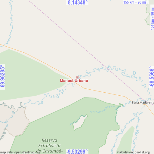
Manoel Urbano GPS coordinates[2]
8° 50' 20.004" South, 69° 15' 34.992" West
| Map corner | latitude | longitude |
|---|---|---|
| Upper-left | -8.14348°, | -69.96285° |
| Center: | -8.83889°, | -69.25972° |
| Lower-right: | -9.53299°, | -68.5566° |
| Map W x H: | 154.5×154.5 km | = 96×96mi |
| max Lat: | 2.81972° ⇑28.3% North |
| Manoel Urbano: | -8.83889° |
| min Lat: | ⇓71.7% South -33.69111° |
| min Long | Manoel Urbano | max Long |
| -72.89583° | -69.25972° | -32.41083° |
| W 0.5%⇐ | ⇒99.5% E |
Elevation
Elevation of Manoel Urbano is 165 m = 541 ft, and this is 215.9 m = 708 ft below average elevation for this country.
| Max E: |
1603 m = 5259 ft | 65.3% |
| Avg. | 380.9 m = 1250 ft | |
| Manoel Urbano | 165 m = 541 ft | |
Min E: |
0 m = 0 ft | 34.7% |
See also: Brazil elevation on elevation.city.
Geographical zone
Manoel Urbano is located in South Torrid zone (between Equator and Tropic of Capricorn). Distance of Equator is 982.8 km =610.7 mi to North.| Distance of | km | miles | from Manoel Urbano |
|---|---|---|---|
| Equator | 982.8 | 610.7 | to North |
| Tropic Capricorn | 1623.1 | 1008.5 | to South |
| Antarctic Circle | 6418.4 | 3988.2 | to South |
| South Pole | 9024.3 | 5607.4 | to South |


Nearby cities:
15 places around Manoel Urbano: (largest is in red/bold)
• Boca do Acre
204.8 km =127.3 mi,  87°
87°
• Brasiléia
248.5 km =154.4 mi,  166°
166°
• Eirunepé
251.5 km =156.3 mi,  344°
344°
• Envira
200.9 km =124.8 mi,  328°
328°
• Extrema
335.1 km =208.2 mi,  108°
108°
• Feijó
141.8 km =88.1 mi,  301°
301°
• Marechal Thaumaturgo
388.2 km =241.2 mi,  268°
268°
• Pauini
280.7 km =174.4 mi,  63°
63°
• Plácido de Castro
281.8 km =175.1 mi,  126°
126°
• Porto Walter
388.3 km =241.3 mi,  279°
279°
• Rio Branco
203.1 km =126.2 mi, 128°
• Sena Madureira
69.2 km =43 mi, 111°
• Senador Guiomard
221.6 km =137.7 mi, 131°
• Tarauacá
181.9 km =113 mi,  294°
294°
• Xapuri
217.9 km =135.4 mi,  157°
157°
Sources, notices
• [Note1] Compared only with cities in Brazil existing in our database
• [Src1] Map data: © OpenStreetMap contributors (CC-BY-SA)
• [Src2] Other city data from geonames.org with taken over terms of usage.
• [Src3] Geographical zone / Annual Mean Temperature by Robert A. Rohde @ Wikipedia
