Enyerhyetykaw geodata
Enyerhyetykaw (Minsk) is a populated place; located in Belarus in Europe/Minsk (GMT+3) time zone. With population of 2,445 people, there are 177 cities with bigger population in this country. Compared to other cities in Belarus, 59.2% of cities are located further ↑North; 67.1% of cities are located further →East and 73% of cities have lower elevation than Enyerhyetykaw. Note1


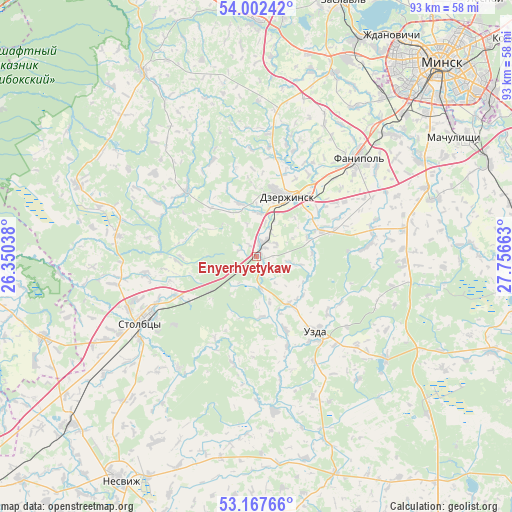
Enyerhyetykaw GPS coordinates[2]
53° 35' 13.56" North, 27° 3' 12.6" East
| Map corner | latitude | longitude |
|---|---|---|
| Upper-left | 54.00242°, | 26.35038° |
| Center: | 53.5871°, | 27.0535° |
| Lower-right: | 53.16766°, | 27.75663° |
| Map W x H: | 92.8×92.8 km | = 57.7×57.7mi |
| max Lat: | 56.0147° ⇑59.2% North |
| Enyerhyetykaw: | 53.5871° |
| min Lat: | ⇓40.8% South 51.75° |
| min Long | Enyerhyetykaw | max Long |
| 23.37083° | 27.0535° | 32.578° |
| W 32.9%⇐ | ⇒67.1% E |
Elevation
Elevation of Enyerhyetykaw is 183 m = 600 ft, and this is 14.4 m = 47 ft above average elevation for this country.
| Max E: |
309 m = 1014 ft | 27% |
| Enyerhyetykaw | 183 m 600 ft | |
| Avg. | 168.6 m = 553 ft | |
Min E: |
108 m = 354 ft | 73% |
See also: Belarus elevation on elevation.city.
Geographical zone
Enyerhyetykaw is located in North temperate zone (between Tropic of Cancer and the Arctic Circle). Distance of this North polar circle is 1442.8 km =896.5 mi to North.| Distance of | km | miles | from Enyerhyetykaw |
|---|---|---|---|
| North Pole | 4048.7 | 2515.7 | to North |
| Arctic Circle | 1442.8 | 896.5 | to North |
| Tropic Cancer | 3352.4 | 2083.1 | to South |
| Equator | 5958.3 | 3702.3 | to South |


Nearby cities:
15 places around Enyerhyetykaw: (largest is in red/bold)
• Atolina
33.1 km =20.6 mi,  49°
49°
• Azyartso
35.8 km =22.2 mi,  38°
38°
• Charkasy
27.2 km =16.9 mi, 42°
• Dzyarzhynsk
12.1 km =7.5 mi,  27°
27°
• Fanipol
25.8 km =16 mi, 45°
• Ivyanyets
39 km =24.2 mi,  328°
328°
• Novosel’ye
37.9 km =23.5 mi,  14°
14°
• Novy Svyerzhan’
26 km =16.2 mi,  235°
235°
• Nyehorelaye
2.9 km =1.8 mi, 26°
• Samakhvalavichy
34.2 km =21.3 mi,  60°
60°
• Schomyslitsa
37 km =23 mi, 45°
• Stan’kava
12.5 km =7.8 mi,  67°
67°
• Stowbtsy
23.8 km =14.8 mi, 239°
• Uzda
17.4 km =10.8 mi,  142°
142°
• Vishnyavyets
35.9 km =22.3 mi,  222°
222°
Sources, notices
• [Note1] Compared only with cities in Belarus existing in our database
• [Src1] Map data: © OpenStreetMap contributors (CC-BY-SA)
• [Src2] Other city data from geonames.org with taken over terms of usage.
• [Src3] Geographical zone / Annual Mean Temperature by Robert A. Rohde @ Wikipedia
