Stan’kava geodata
Stan’kava (Minsk) is a populated place; located in Belarus in Europe/Minsk (GMT+3) time zone. With population of 1,850 people, there are 193 cities with bigger population in this country. Compared to other cities in Belarus, 56.2% of cities are located further ↑North; 62.8% of cities are located further →East and 76% of cities have lower elevation than Stan’kava. Note1


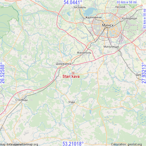
Stan’kava GPS coordinates[2]
53° 37' 45.12" North, 27° 13' 44.4" East
| Map corner | latitude | longitude |
|---|---|---|
| Upper-left | 54.0441°, | 26.52588° |
| Center: | 53.6292°, | 27.229° |
| Lower-right: | 53.21018°, | 27.93213° |
| Map W x H: | 92.7×92.7 km | = 57.6×57.6mi |
| max Lat: | 56.0147° ⇑56.2% North |
| Stan’kava: | 53.6292° |
| min Lat: | ⇓43.8% South 51.75° |
| min Long | Stan’kava | max Long |
| 23.37083° | 27.229° | 32.578° |
| W 37.2%⇐ | ⇒62.8% E |
Elevation
Elevation of Stan’kava is 186 m = 610 ft, and this is 17.4 m = 57 ft above average elevation for this country.
| Max E: |
309 m = 1014 ft | 24% |
| Stan’kava | 186 m 610 ft | |
| Avg. | 168.6 m = 553 ft | |
Min E: |
108 m = 354 ft | 76% |
See also: Belarus elevation on elevation.city.
Geographical zone
Stan’kava is located in North temperate zone (between Tropic of Cancer and the Arctic Circle). Distance of this North polar circle is 1438.2 km =893.7 mi to North.| Distance of | km | miles | from Stan’kava |
|---|---|---|---|
| North Pole | 4044.1 | 2512.9 | to North |
| Arctic Circle | 1438.2 | 893.7 | to North |
| Tropic Cancer | 3357.1 | 2086 | to South |
| Equator | 5963 | 3705.2 | to South |


Nearby cities:
15 places around Stan’kava: (largest is in red/bold)
• Atolina
21.7 km =13.5 mi,  38°
38°
• Azyartso
25.7 km =16 mi,  24°
24°
• Charkasy
16.7 km =10.4 mi, 24°
• Dzyarzhynsk
8.5 km =5.3 mi,  315°
315°
• Enyerhyetykaw
12.5 km =7.8 mi,  247°
247°
• Fanipol
15.1 km =9.4 mi,  27°
27°
• Hatava
32 km =19.9 mi,  57°
57°
• Khatsyezhyna
31.6 km =19.6 mi,  9°
9°
• Machulishchy
29.3 km =18.2 mi, 55°
• Nyehorelaye
10.5 km =6.5 mi,  258°
258°
• Samakhvalavichy
21.9 km =13.6 mi, 55°
• Schomyslitsa
25.9 km =16.1 mi, 34°
• Syenitsa
30.1 km =18.7 mi, 41°
• Uzda
18.5 km =11.5 mi,  183°
183°
• Yubilyeyny
28.6 km =17.8 mi, 42°
Sources, notices
• [Note1] Compared only with cities in Belarus existing in our database
• [Src1] Map data: © OpenStreetMap contributors (CC-BY-SA)
• [Src2] Other city data from geonames.org with taken over terms of usage.
• [Src3] Geographical zone / Annual Mean Temperature by Robert A. Rohde @ Wikipedia
