Kruhlaye geodata
Kruhlaye (Mogilev) is a seat of a second-order administrative division; located in Belarus in Europe/Minsk (GMT+3) time zone. With population of 7,300 people, there are 114 cities with bigger population in this country. Compared to other cities in Belarus, 78% of cities are located further ↓South; 76.6% of cities are located further ←West and 81.9% of cities have lower elevation than Kruhlaye. Note1


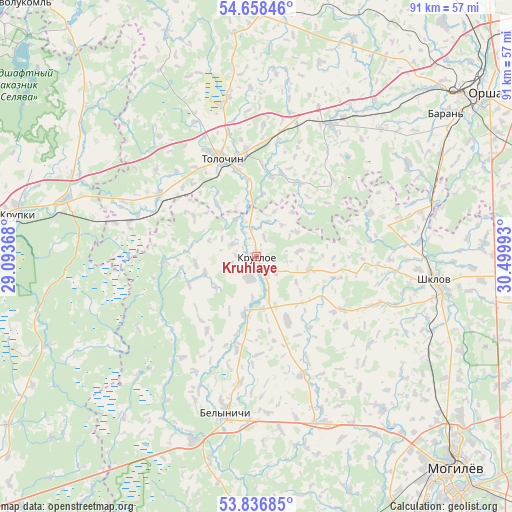
Kruhlaye GPS coordinates[2]
54° 14' 58.92" North, 29° 47' 48.48" East
| Map corner | latitude | longitude |
|---|---|---|
| Upper-left | 54.65846°, | 29.09368° |
| Center: | 54.2497°, | 29.7968° |
| Lower-right: | 53.83685°, | 30.49993° |
| Map W x H: | 91.4×91.4 km | = 56.8×56.8mi |
| max Lat: | 56.0147° ⇑22% North |
| Kruhlaye: | 54.2497° |
| min Lat: | ⇓78% South 51.75° |
| min Long | Kruhlaye | max Long |
| 23.37083° | 29.7968° | 32.578° |
| W 76.6%⇐ | ⇒23.4% E |
Elevation
Elevation of Kruhlaye is 195 m = 640 ft, and this is 26.4 m = 87 ft above average elevation for this country.
| Max E: |
309 m = 1014 ft | 18.1% |
| Kruhlaye | 195 m 640 ft | |
| Avg. | 168.6 m = 553 ft | |
Min E: |
108 m = 354 ft | 81.9% |
See also: Belarus elevation on elevation.city.
Geographical zone
Kruhlaye is located in North temperate zone (between Tropic of Cancer and the Arctic Circle). Distance of this North polar circle is 1369.2 km =850.8 mi to North.| Distance of | km | miles | from Kruhlaye |
|---|---|---|---|
| North Pole | 3975.1 | 2470 | to North |
| Arctic Circle | 1369.2 | 850.8 | to North |
| Tropic Cancer | 3426.1 | 2128.9 | to South |
| Equator | 6032 | 3748.1 | to South |


Nearby cities:
15 places around Kruhlaye: (largest is in red/bold)
• Balbasava
37.2 km =23.1 mi,  59°
59°
• Baran’
42.2 km =26.2 mi,  52°
52°
• Bobr
35.5 km =22.1 mi,  286°
286°
• Byalynichy
28.3 km =17.6 mi,  190°
190°
• Halowchyn
22.5 km =14 mi,  159°
159°
• Kamyennyya Lavy
37 km =23 mi,  118°
118°
• Knyazhytsy
38.3 km =23.8 mi,  142°
142°
• Kokhanava
27 km =16.8 mi,  29°
29°
• Komsyenichy
12.3 km =7.6 mi,  154°
154°
• Kopys’
33 km =20.5 mi,  75°
75°
• Lotva
34.6 km =21.5 mi, 118°
• Shklow
32.2 km =20 mi,  97°
97°
• Talachyn
18.9 km =11.7 mi,  339°
339°
• Vishow
32.5 km =20.2 mi, 156°
• Vyalikaya Mashchanitsa
34.7 km =21.6 mi,  198°
198°
Sources, notices
• [Note1] Compared only with cities in Belarus existing in our database
• [Src1] Map data: © OpenStreetMap contributors (CC-BY-SA)
• [Src2] Other city data from geonames.org with taken over terms of usage.
• [Src3] Geographical zone / Annual Mean Temperature by Robert A. Rohde @ Wikipedia
