Saint-Joseph-de-Coleraine geodata
Saint-Joseph-de-Coleraine (Quebec) is a populated place; located in Canada in America/Toronto (GMT-4) time zone. With population of 1,319 people, there are 912 cities with bigger population in this country. Compared to other cities in Canada, 64.1% of cities are located further ↑North; 79.7% of cities are located further ←West and 67.4% of cities have lower elevation than Saint-Joseph-de-Coleraine. Note1
Administrative division(s):
- Level 1: Quebec
- Level 2: Chaudière-Appalaches
- Level 3: Saint-Joseph-de-Coleraine
Current local time in Saint-Joseph-de-Coleraine:
09:10 AM, FridayDifference from your time zone: hours


Saint-Joseph-de-Coleraine GPS coordinates[2]
45° 58' 0.372" North, 71° 21' 56.772" West
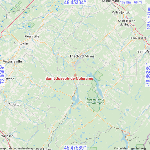
| Map corner | latitude | longitude |
|---|---|---|
| Upper-left | 46.45334°, | -72.0689° |
| Center: | 45.96677°, | -71.36577° |
| Lower-right: | 45.47589°, | -70.66265° |
| Map W x H: | 108.7×108.7 km | = 67.5×67.5mi |
| max Lat: | 73.03752° ⇑64.1% North |
| Saint-Joseph-de-Coleraine: | 45.96677° |
| min Lat: | ⇓35.9% South 42.05009° |
| min Long | Saint-Joseph-de | max Long |
| -139.43328° | -71.36577° | -52.70931° |
| W 79.7%⇐ | ⇒20.3% E |
Elevation
Elevation of Saint-Joseph-de-Coleraine is 273 m = 896 ft, and this is 18.6 m = 61 ft above average elevation for this country.
| Max E: |
1518 m = 4980 ft | 32.6% |
| Saint-Joseph-de-Coleraine | 273 m 896 ft | |
| Avg. | 254.4 m = 835 ft | |
Min E: |
-2 m = -7 ft | 67.4% |
See also: Canada elevation on elevation.city.
Geographical zone
Saint-Joseph-de-Coleraine is located in North temperate zone (between Tropic of Cancer and the Arctic Circle). Distance of this North polar circle is 2290.1 km =1423 mi to North.| Distance of | km | miles | from Saint-Joseph-de-Coleraine |
|---|---|---|---|
| North Pole | 4896 | 3042.2 | to North |
| Arctic Circle | 2290.1 | 1423 | to North |
| Tropic Cancer | 2505.1 | 1556.6 | to South |
| Equator | 5111 | 3175.8 | to South |


Nearby cities:
15 places around Saint-Joseph-de-Coleraine: (largest is in red/bold)
• Adstock
23.8 km =14.8 mi,  67°
67°
• Asbestos
49.2 km =30.6 mi,  243°
243°
• Beauceville
53.2 km =33.1 mi,  58°
58°
• Disraeli
7.5 km =4.7 mi,  170°
170°
• East Broughton
35.4 km =22 mi,  39°
39°
• Plessisville
41.4 km =25.7 mi,  312°
312°
• Princeville
45.4 km =28.2 mi,  300°
300°
• Saint-Joseph-de-Beauce
53.4 km =33.2 mi,  46°
46°
• Saint-Rémi-de-Tingwick
36.5 km =22.7 mi,  252°
252°
• Saint-Éphrem-de-Beauce
34 km =21.1 mi, 70°
• Shenley
41.4 km =25.7 mi,  84°
84°
• Thetford-Mines
14.9 km =9.3 mi,  18°
18°
• Victoriaville
47.3 km =29.4 mi,  281°
281°
• Warwick
47.7 km =29.6 mi,  267°
267°
• Weedon Centre
29.7 km =18.5 mi,  194°
194°
Sources, notices
• [Note1] Compared only with cities in Canada existing in our database
• [Src1] Map data: © OpenStreetMap contributors (CC-BY-SA)
• [Src2] Other city data from geonames.org with taken over terms of usage.
• [Src3] Geographical zone / Annual Mean Temperature by Robert A. Rohde @ Wikipedia
