Shediac geodata
Shediac (New Brunswick) is a populated place; located in Canada in America/Moncton (GMT-3) time zone. With population of 4,735 people, there are 487 cities with bigger population in this country. Compared to other cities in Canada, 58.8% of cities are located further ↑North; 92.5% of cities are located further ←West and 89.1% of cities have higher elevation than Shediac. Note1


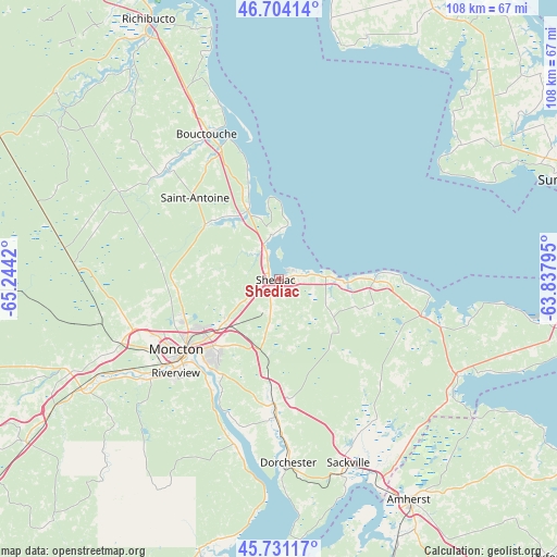
Shediac GPS coordinates[2]
46° 13' 11.316" North, 64° 32' 27.852" West
| Map corner | latitude | longitude |
|---|---|---|
| Upper-left | 46.70414°, | -65.2442° |
| Center: | 46.21981°, | -64.54107° |
| Lower-right: | 45.73117°, | -63.83795° |
| Map W x H: | 108.2×108.2 km | = 67.2×67.2mi |
| max Lat: | 73.03752° ⇑58.8% North |
| Shediac: | 46.21981° |
| min Lat: | ⇓41.2% South 42.05009° |
| min Long | Shediac | max Long |
| -139.43328° | -64.54107° | -52.70931° |
| W 92.5%⇐ | ⇒7.5% E |
Elevation
Elevation of Shediac is 16 m = 52 ft, and this is 238.4 m = 782 ft below average elevation for this country.
| Max E: |
1518 m = 4980 ft | 89.1% |
| Avg. | 254.4 m = 835 ft | |
| Shediac | 16 m = 52 ft | |
Min E: |
-2 m = -7 ft | 10.9% |
See also: Canada elevation on elevation.city.
Geographical zone
Shediac is located in North temperate zone (between Tropic of Cancer and the Arctic Circle). Distance of this North polar circle is 2262 km =1405.5 mi to North.| Distance of | km | miles | from Shediac |
|---|---|---|---|
| North Pole | 4867.9 | 3024.8 | to North |
| Arctic Circle | 2262 | 1405.5 | to North |
| Tropic Cancer | 2533.2 | 1574.1 | to South |
| Equator | 5139.2 | 3193.3 | to South |


Nearby cities:
15 places around Shediac: (largest is in red/bold)
• Bouctouche
31.5 km =19.6 mi,  331°
331°
• Dieppe
19.3 km =12 mi,  215°
215°
• Evergreen Park
27.5 km =17.1 mi,  244°
244°
• Grande-Digue
9.1 km =5.7 mi,  348°
348°
• Greater Lakeburn
18.7 km =11.6 mi,  211°
211°
• Haute-Aboujagane
13.5 km =8.4 mi,  125°
125°
• Lutes Mountain
29.6 km =18.4 mi,  251°
251°
• McEwen
20.6 km =12.8 mi, 246°
• Moncton
24.1 km =15 mi,  234°
234°
• Point de Bute
42.3 km =26.3 mi,  146°
146°
• Sackville
35.6 km =22.1 mi,  160°
160°
• Saint-Antoine
22.6 km =14 mi,  314°
314°
• Salisbury
43.8 km =27.2 mi, 242°
• Shediac Bridge-Shediac River
7.1 km =4.4 mi,  320°
320°
• Shediac Cape
2.4 km =1.5 mi, 308°
Sources, notices
• [Note1] Compared only with cities in Canada existing in our database
• [Src1] Map data: © OpenStreetMap contributors (CC-BY-SA)
• [Src2] Other city data from geonames.org with taken over terms of usage.
• [Src3] Geographical zone / Annual Mean Temperature by Robert A. Rohde @ Wikipedia
