Point de Bute geodata
Point de Bute (New Brunswick) is a populated place; located in Canada in America/Moncton (GMT-3) time zone. With population of 571 people, there are 1158 cities with bigger population in this country. Compared to other cities in Canada, 65.2% of cities are located further ↑North; 93.4% of cities are located further ←West and 84.5% of cities have higher elevation than Point de Bute. Note1


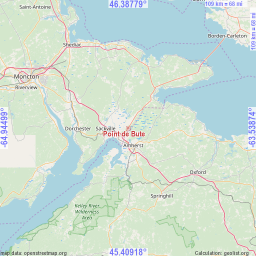
Point de Bute GPS coordinates[2]
45° 54' 2.304" North, 64° 14' 30.696" West
| Map corner | latitude | longitude |
|---|---|---|
| Upper-left | 46.38779°, | -64.94499° |
| Center: | 45.90064°, | -64.24186° |
| Lower-right: | 45.40918°, | -63.53874° |
| Map W x H: | 108.8×108.8 km | = 67.6×67.6mi |
| max Lat: | 73.03752° ⇑65.2% North |
| Point de Bute: | 45.90064° |
| min Lat: | ⇓34.8% South 42.05009° |
| min Long | Point de Bute | max Long |
| -139.43328° | -64.24186° | -52.70931° |
| W 93.4%⇐ | ⇒6.6% E |
Elevation
Elevation of Point de Bute is 23 m = 75 ft, and this is 231.4 m = 759 ft below average elevation for this country.
| Max E: |
1518 m = 4980 ft | 84.5% |
| Avg. | 254.4 m = 835 ft | |
| Point de Bute | 23 m = 75 ft | |
Min E: |
-2 m = -7 ft | 15.5% |
See also: Canada elevation on elevation.city.
Geographical zone
Point de Bute is located in North temperate zone (between Tropic of Cancer and the Arctic Circle). Distance of this North polar circle is 2297.5 km =1427.6 mi to North.| Distance of | km | miles | from Point de Bute |
|---|---|---|---|
| North Pole | 4903.4 | 3046.8 | to North |
| Arctic Circle | 2297.5 | 1427.6 | to North |
| Tropic Cancer | 2497.8 | 1552.1 | to South |
| Equator | 5103.7 | 3171.3 | to South |


Nearby cities:
15 places around Point de Bute: (largest is in red/bold)
• Amherst
8.2 km =5.1 mi,  155°
155°
• Dieppe
39.7 km =24.7 mi,  299°
299°
• Evergreen Park
53.5 km =33.2 mi, 296°
• Grande-Digue
50.9 km =31.6 mi,  330°
330°
• Greater Lakeburn
38.3 km =23.8 mi, 300°
• Haute-Aboujagane
30.1 km =18.7 mi,  336°
336°
• McEwen
50.1 km =31.1 mi, 302°
• Moncton
48 km =29.8 mi, 296°
• Oxford
34.6 km =21.5 mi,  122°
122°
• Parrsboro
55.4 km =34.4 mi,  186°
186°
• Sackville
11.2 km =7 mi,  280°
280°
• Shediac
42.3 km =26.3 mi, 326°
• Shediac Bridge-Shediac River
49.4 km =30.7 mi, 325°
• Shediac Cape
44.6 km =27.7 mi, 325°
• Springhill
31.6 km =19.6 mi,  151°
151°
Sources, notices
• [Note1] Compared only with cities in Canada existing in our database
• [Src1] Map data: © OpenStreetMap contributors (CC-BY-SA)
• [Src2] Other city data from geonames.org with taken over terms of usage.
• [Src3] Geographical zone / Annual Mean Temperature by Robert A. Rohde @ Wikipedia
