Pont-Rouge geodata
Pont-Rouge (Quebec) is a populated place; located in Canada in America/Toronto (GMT-4) time zone. With population of 8,723 people, there are 347 cities with bigger population in this country. Compared to other cities in Canada, 52.9% of cities are located further ↑North; 78.2% of cities are located further ←West and 59% of cities have higher elevation than Pont-Rouge. Note1


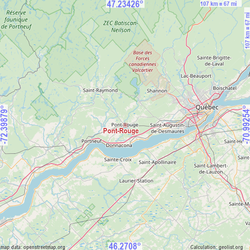
Pont-Rouge GPS coordinates[2]
46° 45' 16.848" North, 71° 41' 44.376" West
| Map corner | latitude | longitude |
|---|---|---|
| Upper-left | 47.23426°, | -72.39879° |
| Center: | 46.75468°, | -71.69566° |
| Lower-right: | 46.2708°, | -70.99254° |
| Map W x H: | 107.1×107.1 km | = 66.5×66.5mi |
| max Lat: | 73.03752° ⇑52.9% North |
| Pont-Rouge: | 46.75468° |
| min Lat: | ⇓47.1% South 42.05009° |
| min Long | Pont-Rouge | max Long |
| -139.43328° | -71.69566° | -52.70931° |
| W 78.2%⇐ | ⇒21.8% E |
Elevation
Elevation of Pont-Rouge is 104 m = 341 ft, and this is 150.4 m = 493 ft below average elevation for this country.
| Max E: |
1518 m = 4980 ft | 59% |
| Avg. | 254.4 m = 835 ft | |
| Pont-Rouge | 104 m = 341 ft | |
Min E: |
-2 m = -7 ft | 41% |
See also: Canada elevation on elevation.city.
Geographical zone
Pont-Rouge is located in North temperate zone (between Tropic of Cancer and the Arctic Circle). Distance of this North polar circle is 2202.5 km =1368.6 mi to North.| Distance of | km | miles | from Pont-Rouge |
|---|---|---|---|
| North Pole | 4808.4 | 2987.8 | to North |
| Arctic Circle | 2202.5 | 1368.6 | to North |
| Tropic Cancer | 2592.7 | 1611 | to South |
| Equator | 5198.6 | 3230.3 | to South |


Nearby cities:
15 places around Pont-Rouge: (largest is in red/bold)
• Breakeyville
36.9 km =22.9 mi,  102°
102°
• Cap-Santé
11.6 km =7.2 mi,  217°
217°
• Donnacona
8.5 km =5.3 mi,  194°
194°
• Fossambault-sur-le-Lac
14.9 km =9.3 mi,  24°
24°
• L'Ancienne-Lorette
26.5 km =16.5 mi,  80°
80°
• La Haute-Saint-Charles
28.9 km =18 mi,  58°
58°
• Lotbinière
23.7 km =14.7 mi,  229°
229°
• Neuville
10.7 km =6.6 mi,  126°
126°
• Portneuf
16.4 km =10.2 mi,  244°
244°
• Saint-Antoine-de-Tilly
13.8 km =8.6 mi,  137°
137°
• Saint-Augustin-de-Desmaures
18.7 km =11.6 mi,  94°
94°
• Saint-Flavien
28 km =17.4 mi,  164°
164°
• Saint-Marc-des-Carrières
28.1 km =17.5 mi,  253°
253°
• Sainte Catherine de la Jacques Cartier
12.3 km =7.6 mi,  27°
27°
• Shannon
19.6 km =12.2 mi,  44°
44°
Sources, notices
• [Note1] Compared only with cities in Canada existing in our database
• [Src1] Map data: © OpenStreetMap contributors (CC-BY-SA)
• [Src2] Other city data from geonames.org with taken over terms of usage.
• [Src3] Geographical zone / Annual Mean Temperature by Robert A. Rohde @ Wikipedia
