Saint-Marc-des-Carrières geodata
Saint-Marc-des-Carrières (Quebec) is a populated place; located in Canada in America/Toronto (GMT-4) time zone. With population of 2,358 people, there are 695 cities with bigger population in this country. Compared to other cities in Canada, 53.8% of cities are located further ↑North; 76.5% of cities are located further ←West and 73.7% of cities have higher elevation than Saint-Marc-des-Carrières. Note1
Administrative division(s):
- Level 1: Quebec
- Level 2: Capitale-Nationale
- Level 3: Saint-Marc-des-Carrières
Current local time in Saint-Marc-des-Carrières:
05:02 AM, FridayDifference from your time zone: hours


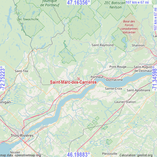
Saint-Marc-des-Carrières GPS coordinates[2]
46° 41' 0.06" North, 72° 2' 56.76" West
| Map corner | latitude | longitude |
|---|---|---|
| Upper-left | 47.16356°, | -72.75223° |
| Center: | 46.68335°, | -72.0491° |
| Lower-right: | 46.19883°, | -71.34598° |
| Map W x H: | 107.3×107.3 km | = 66.7×66.7mi |
| max Lat: | 73.03752° ⇑53.8% North |
| Saint-Marc-des-Carrières: | 46.68335° |
| min Lat: | ⇓46.2% South 42.05009° |
| min Long | Saint-Marc-des- | max Long |
| -139.43328° | -72.0491° | -52.70931° |
| W 76.5%⇐ | ⇒23.5% E |
Elevation
Elevation of Saint-Marc-des-Carrières is 47 m = 154 ft, and this is 207.4 m = 680 ft below average elevation for this country.
| Max E: |
1518 m = 4980 ft | 73.7% |
| Avg. | 254.4 m = 835 ft | |
| Saint-Marc-des-Carrières | 47 m = 154 ft | |
Min E: |
-2 m = -7 ft | 26.3% |
See also: Canada elevation on elevation.city.
Geographical zone
Saint-Marc-des-Carrières is located in North temperate zone (between Tropic of Cancer and the Arctic Circle). Distance of this North polar circle is 2210.5 km =1373.5 mi to North.| Distance of | km | miles | from Saint-Marc-des-Carrières |
|---|---|---|---|
| North Pole | 4816.4 | 2992.8 | to North |
| Arctic Circle | 2210.5 | 1373.5 | to North |
| Tropic Cancer | 2584.8 | 1606.1 | to South |
| Equator | 5190.7 | 3225.4 | to South |


Nearby cities:
15 places around Saint-Marc-des-Carrières: (largest is in red/bold)
• Cap-Santé
20 km =12.4 mi,  93°
93°
• Donnacona
24.8 km =15.4 mi, 90°
• Fossambault-sur-le-Lac
39.4 km =24.5 mi,  56°
56°
• Hérouxville
44 km =27.3 mi,  267°
267°
• Lotbinière
11.6 km =7.2 mi,  129°
129°
• Neuville
35.6 km =22.1 mi, 87°
• Pont-Rouge
28.1 km =17.5 mi,  73°
73°
• Portneuf
12.2 km =7.6 mi, 86°
• Saint-Antoine-de-Tilly
36.4 km =22.6 mi, 93°
• Saint-Augustin-de-Desmaures
46 km =28.6 mi,  82°
82°
• Saint-Flavien
39.5 km =24.5 mi,  118°
118°
• Saint-Pierre-les-Becquets
23.4 km =14.5 mi,  209°
209°
• Saint-Tite
39.8 km =24.7 mi,  278°
278°
• Sainte Catherine de la Jacques Cartier
37.7 km =23.4 mi, 60°
• Sainte-Thècle
37.4 km =23.2 mi,  293°
293°
Sources, notices
• [Note1] Compared only with cities in Canada existing in our database
• [Src1] Map data: © OpenStreetMap contributors (CC-BY-SA)
• [Src2] Other city data from geonames.org with taken over terms of usage.
• [Src3] Geographical zone / Annual Mean Temperature by Robert A. Rohde @ Wikipedia
