Römerswil geodata
Römerswil (Lucerne) is a populated place; located in Switzerland in Europe/Zurich (GMT+2) time zone. With population of 1,882 people, there are 877 cities with bigger population in this country. Compared to other cities in Switzerland, 55.2% of cities are located further ↑North; 54.4% of cities are located further →East and 84.2% of cities have lower elevation than Römerswil. Note1


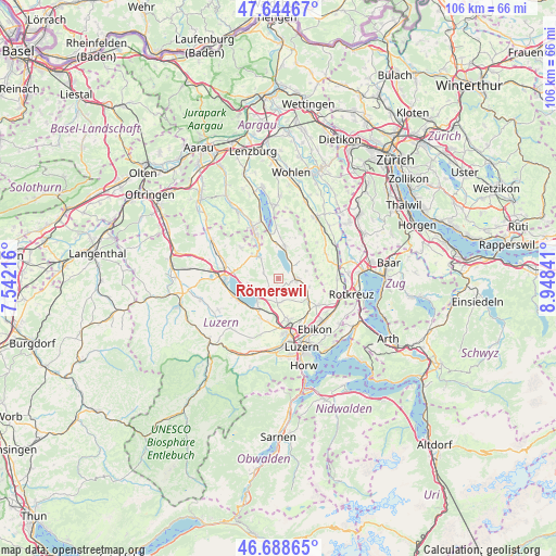
Römerswil GPS coordinates[2]
47° 10' 7.716" North, 8° 14' 43.008" East
| Map corner | latitude | longitude |
|---|---|---|
| Upper-left | 47.64467°, | 7.54216° |
| Center: | 47.16881°, | 8.24528° |
| Lower-right: | 46.68865°, | 8.94841° |
| Map W x H: | 106.3×106.3 km | = 66.1×66.1mi |
| max Lat: | 47.76737° ⇑55.2% North |
| Römerswil: | 47.16881° |
| min Lat: | ⇓44.8% South 45.83203° |
| min Long | Römerswil | max Long |
| 5.97153° | 8.24528° | 10.44624° |
| W 45.6%⇐ | ⇒54.4% E |
Elevation
Elevation of Römerswil is 723 m = 2372 ft, and this is 164.8 m = 541 ft above average elevation for this country.
| Max E: |
1845 m = 6053 ft | 15.8% |
| Römerswil | 723 m 2372 ft | |
| Avg. | 558.2 m = 1831 ft | |
Min E: |
197 m = 646 ft | 84.2% |
See also: Switzerland elevation on elevation.city.
Geographical zone
Römerswil is located in North temperate zone (between Tropic of Cancer and the Arctic Circle). Distance of this North polar circle is 2156.5 km =1340 mi to North.| Distance of | km | miles | from Römerswil |
|---|---|---|---|
| North Pole | 4762.4 | 2959.2 | to North |
| Arctic Circle | 2156.5 | 1340 | to North |
| Tropic Cancer | 2638.8 | 1639.7 | to South |
| Equator | 5244.7 | 3258.9 | to South |


Nearby cities:
15 places around Römerswil: (largest is in red/bold)
• Ballwil
6.1 km =3.8 mi,  106°
106°
• Beromünster
5.7 km =3.5 mi,  316°
316°
• Eich
6.2 km =3.9 mi,  251°
251°
• Gelfingen
5.3 km =3.3 mi,  16°
16°
• Gunzwil
6.8 km =4.2 mi,  313°
313°
• Hildisrieden
2.5 km =1.6 mi,  216°
216°
• Hitzkirch
6.3 km =3.9 mi,  13°
13°
• Hochdorf
3.5 km =2.2 mi,  90°
90°
• Hohenrain
5.7 km =3.5 mi,  76°
76°
• Menziken
8.9 km =5.5 mi,  332°
332°
• Neudorf
2.9 km =1.8 mi,  288°
288°
• Neuenkirch
8.3 km =5.2 mi,  202°
202°
• Nottwil
9 km =5.6 mi,  244°
244°
• Schenkon
8.6 km =5.3 mi,  276°
276°
• Sempach
5.5 km =3.4 mi,  227°
227°
Sources, notices
• [Note1] Compared only with cities in Switzerland existing in our database
• [Src1] Map data: © OpenStreetMap contributors (CC-BY-SA)
• [Src2] Other city data from geonames.org with taken over terms of usage.
• [Src3] Geographical zone / Annual Mean Temperature by Robert A. Rohde @ Wikipedia
