Hohenrain geodata
Hohenrain (Lucerne) is a populated place; located in Switzerland in Europe/Zurich (GMT+2) time zone. With population of 2,090 people, there are 808 cities with bigger population in this country. Compared to other cities in Switzerland, 54.1% of cities are located further ↑North; 52.7% of cities are located further →East and 73.7% of cities have lower elevation than Hohenrain. Note1


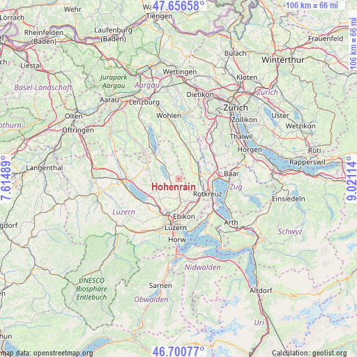
Hohenrain GPS coordinates[2]
47° 10' 50.988" North, 8° 19' 4.872" East
| Map corner | latitude | longitude |
|---|---|---|
| Upper-left | 47.65658°, | 7.61489° |
| Center: | 47.18083°, | 8.31802° |
| Lower-right: | 46.70077°, | 9.02114° |
| Map W x H: | 106.3×106.3 km | = 66.1×66.1mi |
| max Lat: | 47.76737° ⇑54.1% North |
| Hohenrain: | 47.18083° |
| min Lat: | ⇓45.9% South 45.83203° |
| min Long | Hohenrain | max Long |
| 5.97153° | 8.31802° | 10.44624° |
| W 47.3%⇐ | ⇒52.7% E |
Elevation
Elevation of Hohenrain is 604 m = 1982 ft, and this is 45.8 m = 150 ft above average elevation for this country.
| Max E: |
1845 m = 6053 ft | 26.3% |
| Hohenrain | 604 m 1982 ft | |
| Avg. | 558.2 m = 1831 ft | |
Min E: |
197 m = 646 ft | 73.7% |
See also: Switzerland elevation on elevation.city.
Geographical zone
Hohenrain is located in North temperate zone (between Tropic of Cancer and the Arctic Circle). Distance of this North polar circle is 2155.2 km =1339.2 mi to North.| Distance of | km | miles | from Hohenrain |
|---|---|---|---|
| North Pole | 4761 | 2958.3 | to North |
| Arctic Circle | 2155.2 | 1339.2 | to North |
| Tropic Cancer | 2640.1 | 1640.5 | to South |
| Equator | 5246 | 3259.7 | to South |


Nearby cities:
15 places around Hohenrain: (largest is in red/bold)
• Auw
4.9 km =3 mi,  47°
47°
• Ballwil
3 km =1.9 mi,  173°
173°
• Dietwil
6.9 km =4.3 mi,  123°
123°
• Gelfingen
5.5 km =3.4 mi,  313°
313°
• Hildisrieden
7.7 km =4.8 mi,  244°
244°
• Hitzkirch
6.3 km =3.9 mi,  319°
319°
• Hochdorf
2.4 km =1.5 mi, 235°
• Hünenberg
8.1 km =5 mi,  94°
94°
• Inwil
6.6 km =4.1 mi,  159°
159°
• Mühlau
7.6 km =4.7 mi, 45°
• Neudorf
8.2 km =5.1 mi,  267°
267°
• Oberrüti
6 km =3.7 mi,  105°
105°
• Root
9.2 km =5.7 mi,  143°
143°
• Römerswil
5.7 km =3.5 mi,  256°
256°
• Sins
5.9 km =3.7 mi,  76°
76°
Sources, notices
• [Note1] Compared only with cities in Switzerland existing in our database
• [Src1] Map data: © OpenStreetMap contributors (CC-BY-SA)
• [Src2] Other city data from geonames.org with taken over terms of usage.
• [Src3] Geographical zone / Annual Mean Temperature by Robert A. Rohde @ Wikipedia
