Lostallo geodata
Lostallo (Grisons) is a populated place; located in Switzerland in Europe/Zurich (GMT+2) time zone. With population of 691 people, there are 1608 cities with bigger population in this country. Compared to other cities in Switzerland, 90% of cities are located further ↑North; 92.8% of cities are located further ←West and 78.4% of cities have higher elevation than Lostallo. Note1


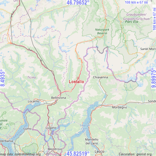
Lostallo GPS coordinates[2]
46° 18' 46.836" North, 9° 11' 47.868" East
| Map corner | latitude | longitude |
|---|---|---|
| Upper-left | 46.79652°, | 8.4935° |
| Center: | 46.31301°, | 9.19663° |
| Lower-right: | 45.82519°, | 9.89975° |
| Map W x H: | 108×108 km | = 67.1×67.1mi |
| max Lat: | 47.76737° ⇑90% North |
| Lostallo: | 46.31301° |
| min Lat: | ⇓10% South 45.83203° |
| min Long | Lostallo | max Long |
| 5.97153° | 9.19663° | 10.44624° |
| W 92.8%⇐ | ⇒7.2% E |
Elevation
Elevation of Lostallo is 425 m = 1394 ft, and this is 133.2 m = 437 ft below average elevation for this country.
| Max E: |
1845 m = 6053 ft | 78.4% |
| Avg. | 558.2 m = 1831 ft | |
| Lostallo | 425 m = 1394 ft | |
Min E: |
197 m = 646 ft | 21.6% |
See also: Switzerland elevation on elevation.city.
Geographical zone
Lostallo is located in North temperate zone (between Tropic of Cancer and the Arctic Circle). Distance of this North polar circle is 2251.7 km =1399.1 mi to North.| Distance of | km | miles | from Lostallo |
|---|---|---|---|
| North Pole | 4857.5 | 3018.3 | to North |
| Arctic Circle | 2251.7 | 1399.1 | to North |
| Tropic Cancer | 2543.6 | 1580.5 | to South |
| Equator | 5149.5 | 3199.7 | to South |


Nearby cities:
15 places around Lostallo: (largest is in red/bold)
• Arvigo
6.5 km =4 mi,  259°
259°
• Braggio
5.7 km =3.5 mi, 258°
• Buseno
8.1 km =5 mi,  237°
237°
• Cauco
6.3 km =3.9 mi,  293°
293°
• Claro
14.7 km =9.1 mi,  245°
245°
• Cresciano
15.4 km =9.6 mi, 255°
• Gnosca
16.1 km =10 mi, 236°
• Gorduno
16.7 km =10.4 mi,  229°
229°
• Grono
8.1 km =5 mi,  207°
207°
• Lodrino
16.7 km =10.4 mi,  265°
265°
• Lumino
13.7 km =8.5 mi, 227°
• Mesocco
9.4 km =5.8 mi,  17°
17°
• Osogna
16.2 km =10.1 mi, 269°
• San Vittore
10.9 km =6.8 mi,  219°
219°
• Santa Maria in Calanca
6.9 km =4.3 mi, 215°
Sources, notices
• [Note1] Compared only with cities in Switzerland existing in our database
• [Src1] Map data: © OpenStreetMap contributors (CC-BY-SA)
• [Src2] Other city data from geonames.org with taken over terms of usage.
• [Src3] Geographical zone / Annual Mean Temperature by Robert A. Rohde @ Wikipedia
