Lignières geodata
Lignières (Neuchâtel) is a populated place; located in Switzerland in Europe/Zurich (GMT+2) time zone. With population of 982 people, there are 1341 cities with bigger population in this country. Compared to other cities in Switzerland, 59.9% of cities are located further ↑North; 85.9% of cities are located further →East and 88.8% of cities have lower elevation than Lignières. Note1


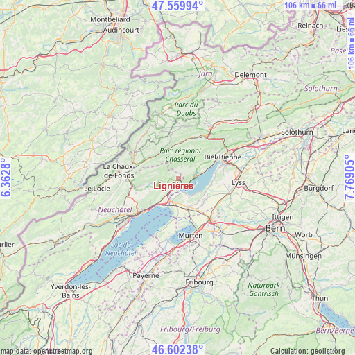
Lignières GPS coordinates[2]
47° 4' 59.916" North, 7° 3' 57.312" East
| Map corner | latitude | longitude |
|---|---|---|
| Upper-left | 47.55994°, | 6.3628° |
| Center: | 47.08331°, | 7.06592° |
| Lower-right: | 46.60238°, | 7.76905° |
| Map W x H: | 106.5×106.5 km | = 66.2×66.2mi |
| max Lat: | 47.76737° ⇑59.9% North |
| Lignières: | 47.08331° |
| min Lat: | ⇓40.1% South 45.83203° |
| min Long | Lignières | max Long |
| 5.97153° | 7.06592° | 10.44624° |
| W 14.1%⇐ | ⇒85.9% E |
Elevation
Elevation of Lignières is 795 m = 2608 ft, and this is 236.8 m = 777 ft above average elevation for this country.
| Max E: |
1845 m = 6053 ft | 11.2% |
| Lignières | 795 m 2608 ft | |
| Avg. | 558.2 m = 1831 ft | |
Min E: |
197 m = 646 ft | 88.8% |
See also: Switzerland elevation on elevation.city.
Geographical zone
Lignières is located in North temperate zone (between Tropic of Cancer and the Arctic Circle). Distance of this North polar circle is 2166 km =1345.9 mi to North.| Distance of | km | miles | from Lignières |
|---|---|---|---|
| North Pole | 4771.9 | 2965.1 | to North |
| Arctic Circle | 2166 | 1345.9 | to North |
| Tropic Cancer | 2629.3 | 1633.8 | to South |
| Equator | 5235.2 | 3253 | to South |


Nearby cities:
15 places around Lignières: (largest is in red/bold)
• Brüttelen
9.2 km =5.7 mi,  137°
137°
• Cornaux
6 km =3.7 mi,  216°
216°
• Dombresson
8.2 km =5.1 mi,  261°
261°
• Erlach
5.2 km =3.2 mi,  152°
152°
• Gals
6.2 km =3.9 mi,  189°
189°
• Gampelen
8 km =5 mi,  184°
184°
• Grand-Savagnier
9.1 km =5.7 mi,  246°
246°
• Ins
9.1 km =5.7 mi,  160°
160°
• La Neuveville
3.1 km =1.9 mi,  129°
129°
• Lamboing
6.4 km =4 mi,  54°
54°
• Le Landeron
2.9 km =1.8 mi,  173°
173°
• Ligerz
5.2 km =3.2 mi,  89°
89°
• Nods
3.7 km =2.3 mi,  17°
17°
• Twann
7 km =4.3 mi,  80°
80°
• Villeret
9.1 km =5.7 mi,  336°
336°
Sources, notices
• [Note1] Compared only with cities in Switzerland existing in our database
• [Src1] Map data: © OpenStreetMap contributors (CC-BY-SA)
• [Src2] Other city data from geonames.org with taken over terms of usage.
• [Src3] Geographical zone / Annual Mean Temperature by Robert A. Rohde @ Wikipedia
