Gampelen geodata
Gampelen (Bern) is a populated place; located in Switzerland in Europe/Zurich (GMT+2) time zone. With population of 732 people, there are 1558 cities with bigger population in this country. Compared to other cities in Switzerland, 63.9% of cities are located further ↑North; 86.2% of cities are located further →East and 76.6% of cities have higher elevation than Gampelen. Note1


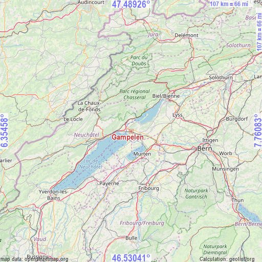
Gampelen GPS coordinates[2]
47° 0' 43.164" North, 7° 3' 27.756" East
| Map corner | latitude | longitude |
|---|---|---|
| Upper-left | 47.48926°, | 6.35458° |
| Center: | 47.01199°, | 7.05771° |
| Lower-right: | 46.53041°, | 7.76083° |
| Map W x H: | 106.6×106.6 km | = 66.2×66.2mi |
| max Lat: | 47.76737° ⇑63.9% North |
| Gampelen: | 47.01199° |
| min Lat: | ⇓36.1% South 45.83203° |
| min Long | Gampelen | max Long |
| 5.97153° | 7.05771° | 10.44624° |
| W 13.8%⇐ | ⇒86.2% E |
Elevation
Elevation of Gampelen is 428 m = 1404 ft, and this is 130.2 m = 427 ft below average elevation for this country.
| Max E: |
1845 m = 6053 ft | 76.6% |
| Avg. | 558.2 m = 1831 ft | |
| Gampelen | 428 m = 1404 ft | |
Min E: |
197 m = 646 ft | 23.4% |
See also: Switzerland elevation on elevation.city.
Geographical zone
Gampelen is located in North temperate zone (between Tropic of Cancer and the Arctic Circle). Distance of this North polar circle is 2173.9 km =1350.8 mi to North.| Distance of | km | miles | from Gampelen |
|---|---|---|---|
| North Pole | 4779.8 | 2970 | to North |
| Arctic Circle | 2173.9 | 1350.8 | to North |
| Tropic Cancer | 2621.3 | 1628.8 | to South |
| Equator | 5227.2 | 3248 | to South |


Nearby cities:
15 places around Gampelen: (largest is in red/bold)
• Bas-Vully
6.9 km =4.3 mi,  143°
143°
• Brüttelen
6.9 km =4.3 mi,  80°
80°
• Cornaux
4.3 km =2.7 mi,  316°
316°
• Cudrefin
6.9 km =4.3 mi,  205°
205°
• Erlach
4.5 km =2.8 mi,  41°
41°
• Gals
1.9 km =1.2 mi,  346°
346°
• Grand-Savagnier
8.9 km =5.5 mi,  299°
299°
• Ins
3.7 km =2.3 mi,  100°
100°
• La Neuveville
6.7 km =4.2 mi,  26°
26°
• Le Landeron
5.1 km =3.2 mi,  10°
10°
• Ligerz
9.9 km =6.2 mi, 36°
• Lignières
8 km =5 mi,  4°
4°
• Marin-Epagnier
4.4 km =2.7 mi,  267°
267°
• Müntschemier
7 km =4.3 mi,  105°
105°
• Saint-Blaise
5.3 km =3.3 mi, 273°
Sources, notices
• [Note1] Compared only with cities in Switzerland existing in our database
• [Src1] Map data: © OpenStreetMap contributors (CC-BY-SA)
• [Src2] Other city data from geonames.org with taken over terms of usage.
• [Src3] Geographical zone / Annual Mean Temperature by Robert A. Rohde @ Wikipedia
