Villeret geodata
Villeret (Bern) is a populated place; located in Switzerland in Europe/Zurich (GMT+2) time zone. With population of 915 people, there are 1397 cities with bigger population in this country. Compared to other cities in Switzerland, 55.7% of cities are located further ↑North; 87.1% of cities are located further →East and 85.3% of cities have lower elevation than Villeret. Note1


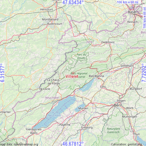
Villeret GPS coordinates[2]
47° 9' 30.168" North, 7° 1' 8.004" East
| Map corner | latitude | longitude |
|---|---|---|
| Upper-left | 47.63434°, | 6.31577° |
| Center: | 47.15838°, | 7.01889° |
| Lower-right: | 46.67812°, | 7.72202° |
| Map W x H: | 106.3×106.3 km | = 66.1×66.1mi |
| max Lat: | 47.76737° ⇑55.7% North |
| Villeret: | 47.15838° |
| min Lat: | ⇓44.3% South 45.83203° |
| min Long | Villeret | max Long |
| 5.97153° | 7.01889° | 10.44624° |
| W 12.9%⇐ | ⇒87.1% E |
Elevation
Elevation of Villeret is 744 m = 2441 ft, and this is 185.8 m = 610 ft above average elevation for this country.
| Max E: |
1845 m = 6053 ft | 14.7% |
| Villeret | 744 m 2441 ft | |
| Avg. | 558.2 m = 1831 ft | |
Min E: |
197 m = 646 ft | 85.3% |
See also: Switzerland elevation on elevation.city.
Geographical zone
Villeret is located in North temperate zone (between Tropic of Cancer and the Arctic Circle). Distance of this North polar circle is 2157.7 km =1340.7 mi to North.| Distance of | km | miles | from Villeret |
|---|---|---|---|
| North Pole | 4763.5 | 2959.9 | to North |
| Arctic Circle | 2157.7 | 1340.7 | to North |
| Tropic Cancer | 2637.6 | 1638.9 | to South |
| Equator | 5243.5 | 3258.2 | to South |


Nearby cities:
15 places around Villeret: (largest is in red/bold)
• Corgémont
10.4 km =6.5 mi,  67°
67°
• Courtelary
4.6 km =2.9 mi,  61°
61°
• Dombresson
10.6 km =6.6 mi,  205°
205°
• La Neuveville
11.9 km =7.4 mi,  150°
150°
• Lamboing
9.9 km =6.2 mi,  117°
117°
• Le Landeron
11.9 km =7.4 mi,  160°
160°
• Le Noirmont
8.7 km =5.4 mi,  327°
327°
• Les Bois
8.9 km =5.5 mi,  283°
283°
• Les Breuleux
5.9 km =3.7 mi,  351°
351°
• Ligerz
12.1 km =7.5 mi,  133°
133°
• Lignières
9.1 km =5.7 mi, 156°
• Nods
6.7 km =4.2 mi,  136°
136°
• Saignelégier
11 km =6.8 mi, 351°
• Saint-Imier
1.8 km =1.1 mi,  249°
249°
• Tramelan
9.6 km =6 mi,  41°
41°
Sources, notices
• [Note1] Compared only with cities in Switzerland existing in our database
• [Src1] Map data: © OpenStreetMap contributors (CC-BY-SA)
• [Src2] Other city data from geonames.org with taken over terms of usage.
• [Src3] Geographical zone / Annual Mean Temperature by Robert A. Rohde @ Wikipedia
