Langnau / Langnau (Dorf) geodata
Langnau / Langnau (Dorf) (Zurich) is a section of populated place; located in Switzerland in Europe/Zurich (GMT+2) time zone. With population of 4,745 people, there are 365 cities with bigger population in this country. Compared to other cities in Switzerland, 56.5% of cities are located further ↓South; 60.4% of cities are located further ←West and 61.7% of cities have lower elevation than Langnau / Langnau (Dorf). Note1
Current local time in Langnau / Langnau (Dorf):
08:58 AM, SaturdayDifference from your time zone: hours


Langnau / Langnau (Dorf) GPS coordinates[2]
47° 17' 11.148" North, 8° 32' 10.572" East
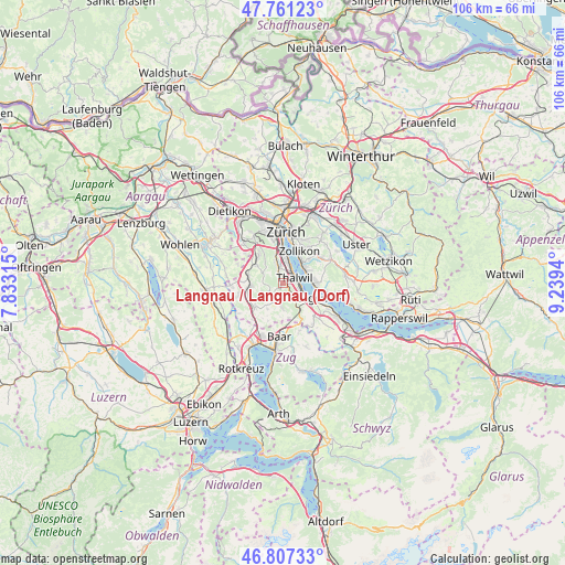
| Map corner | latitude | longitude |
|---|---|---|
| Upper-left | 47.76123°, | 7.83315° |
| Center: | 47.28643°, | 8.53627° |
| Lower-right: | 46.80733°, | 9.2394° |
| Map W x H: | 106.1×106.1 km | = 65.9×65.9mi |
| max Lat: | 47.76737° ⇑43.5% North |
| Langnau / Langnau (Dorf): | 47.28643° |
| min Lat: | ⇓56.5% South 45.83203° |
| min Long | Langnau / Langn | max Long |
| 5.97153° | 8.53627° | 10.44624° |
| W 60.4%⇐ | ⇒39.6% E |
Elevation
Elevation of Langnau / Langnau (Dorf) is 530 m = 1739 ft, and this is 28.2 m = 93 ft below average elevation for this country.
| Max E: |
1845 m = 6053 ft | 38.3% |
| Avg. | 558.2 m = 1831 ft | |
| Langnau / Langnau (Dorf) | 530 m = 1739 ft | |
Min E: |
197 m = 646 ft | 61.7% |
See also: Switzerland elevation on elevation.city.
Geographical zone
Langnau / Langnau (Dorf) is located in North temperate zone (between Tropic of Cancer and the Arctic Circle). Distance of this North polar circle is 2143.4 km =1331.8 mi to North.| Distance of | km | miles | from Langnau / Langnau (Dorf) |
|---|---|---|---|
| North Pole | 4749.3 | 2951.1 | to North |
| Arctic Circle | 2143.4 | 1331.8 | to North |
| Tropic Cancer | 2651.8 | 1647.8 | to South |
| Equator | 5257.8 | 3267 | to South |


Nearby cities:
15 places around Langnau / Langnau (Dorf): (largest is in red/bold)
• Adliswil / Buttenau
1.7 km =1.1 mi,  333°
333°
• Adliswil / Büchel
1.9 km =1.2 mi,  324°
324°
• Adliswil / Sihlau
1.9 km =1.2 mi,  339°
339°
• Adliswil / Wacht
2.4 km =1.5 mi,  351°
351°
• Adliswil / Wanneten
2.3 km =1.4 mi, 329°
• Gattikon
0.9 km =0.6 mi,  104°
104°
• Langnau / Vitaquartier
0.8 km =0.5 mi,  6°
6°
• Langnau am Albis
0.5 km =0.3 mi,  53°
53°
• Mühlehalde
0.4 km =0.2 mi,  205°
205°
• Rüschlikon
2.5 km =1.6 mi,  26°
26°
• Rüschlikon / Alte Landstrasse
2.4 km =1.5 mi,  35°
35°
• Thalwil
2.1 km =1.3 mi,  73°
73°
• Thalwil / Berg
1.6 km =1 mi, 68°
• Thalwil / Dorfkern
2.3 km =1.4 mi,  78°
78°
• Thalwil / Nord
1.9 km =1.2 mi, 50°
Sources, notices
• [Note1] Compared only with cities in Switzerland existing in our database
• [Src1] Map data: © OpenStreetMap contributors (CC-BY-SA)
• [Src2] Other city data from geonames.org with taken over terms of usage.
• [Src3] Geographical zone / Annual Mean Temperature by Robert A. Rohde @ Wikipedia
