Thalwil / Dorfkern geodata
Thalwil / Dorfkern (Zurich) is a section of populated place; located in Switzerland in Europe/Zurich (GMT+2) time zone. With population of 6,829 people, there are 233 cities with bigger population in this country. Compared to other cities in Switzerland, 56.9% of cities are located further ↓South; 62.8% of cities are located further ←West and 53.7% of cities have higher elevation than Thalwil / Dorfkern. Note1


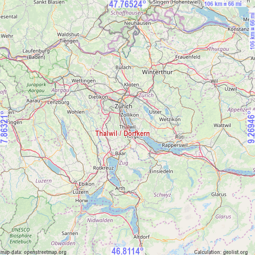
Thalwil / Dorfkern GPS coordinates[2]
47° 17' 25.692" North, 8° 33' 58.788" East
| Map corner | latitude | longitude |
|---|---|---|
| Upper-left | 47.76524°, | 7.86321° |
| Center: | 47.29047°, | 8.56633° |
| Lower-right: | 46.8114°, | 9.26946° |
| Map W x H: | 106.1×106.1 km | = 65.9×65.9mi |
| max Lat: | 47.76737° ⇑43.1% North |
| Thalwil / Dorfkern: | 47.29047° |
| min Lat: | ⇓56.9% South 45.83203° |
| min Long | Thalwil / Dorfk | max Long |
| 5.97153° | 8.56633° | 10.44624° |
| W 62.8%⇐ | ⇒37.2% E |
Elevation
Elevation of Thalwil / Dorfkern is 470 m = 1542 ft, and this is 88.2 m = 289 ft below average elevation for this country.
| Max E: |
1845 m = 6053 ft | 53.7% |
| Avg. | 558.2 m = 1831 ft | |
| Thalwil / Dorfkern | 470 m = 1542 ft | |
Min E: |
197 m = 646 ft | 46.3% |
See also: Switzerland elevation on elevation.city.
Geographical zone
Thalwil / Dorfkern is located in North temperate zone (between Tropic of Cancer and the Arctic Circle). Distance of this North polar circle is 2143 km =1331.6 mi to North.| Distance of | km | miles | from Thalwil / Dorfkern |
|---|---|---|---|
| North Pole | 4748.9 | 2950.8 | to North |
| Arctic Circle | 2143 | 1331.6 | to North |
| Tropic Cancer | 2652.3 | 1648.1 | to South |
| Equator | 5258.2 | 3267.3 | to South |


Nearby cities:
15 places around Thalwil / Dorfkern: (largest is in red/bold)
• Gattikon
1.5 km =0.9 mi,  243°
243°
• Langnau / Langnau (Dorf)
2.3 km =1.4 mi,  258°
258°
• Langnau / Vitaquartier
2.2 km =1.4 mi,  279°
279°
• Langnau am Albis
1.9 km =1.2 mi, 264°
• Oberrieden
2 km =1.2 mi,  152°
152°
• Oberrieden / Berg
1.6 km =1 mi,  163°
163°
• Oberrieden / Mitte
2.3 km =1.4 mi, 152°
• Oberrieden / See
2.1 km =1.3 mi, 145°
• Rüschlikon
2.1 km =1.3 mi,  328°
328°
• Rüschlikon / Alte Landstrasse
1.7 km =1.1 mi, 328°
• Thalwil
0.3 km =0.2 mi,  303°
303°
• Thalwil / Berg
0.8 km =0.5 mi, 280°
• Thalwil / Nord
1.1 km =0.7 mi,  315°
315°
• Thalwil / See
0.5 km =0.3 mi,  29°
29°
• Thalwil / Süd
0.7 km =0.4 mi, 158°
Sources, notices
• [Note1] Compared only with cities in Switzerland existing in our database
• [Src1] Map data: © OpenStreetMap contributors (CC-BY-SA)
• [Src2] Other city data from geonames.org with taken over terms of usage.
• [Src3] Geographical zone / Annual Mean Temperature by Robert A. Rohde @ Wikipedia
