Rüschlikon / Alte Landstrasse geodata
Rüschlikon / Alte Landstrasse (Zurich) is a section of populated place; located in Switzerland in Europe/Zurich (GMT+2) time zone. With population of 546 people, there are 1751 cities with bigger population in this country. Compared to other cities in Switzerland, 58.5% of cities are located further ↓South; 62.1% of cities are located further ←West and 58.7% of cities have higher elevation than Rüschlikon / Alte Landstrasse. Note1
Current local time in Rüschlikon / Alte Landstrasse:
06:19 AM, SaturdayDifference from your time zone: hours


Rüschlikon / Alte Landstrasse GPS coordinates[2]
47° 18' 13.608" North, 8° 33' 15.372" East
| Map corner | latitude | longitude |
|---|---|---|
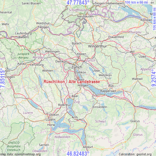
| Upper-left | 47.77843°, | 7.85115° |
| Center: | 47.30378°, | 8.55427° |
| Lower-right: | 46.82483°, | 9.2574° |
| Map W x H: | 106×106 km | = 65.9×65.9mi |
| max Lat: | 47.76737° ⇑41.5% North |
| Rüschlikon / Alte Landstrasse: | 47.30378° |
| min Lat: | ⇓58.5% South 45.83203° |
| min Long | Rüschlikon / A | max Long |
| 5.97153° | 8.55427° | 10.44624° |
| W 62.1%⇐ | ⇒37.9% E |
Elevation
Elevation of Rüschlikon / Alte Landstrasse is 457 m = 1499 ft, and this is 101.2 m = 332 ft below average elevation for this country.
| Max E: |
1845 m = 6053 ft | 58.7% |
| Avg. | 558.2 m = 1831 ft | |
| Rüschlikon / Alte Landstrasse | 457 m = 1499 ft | |
Min E: |
197 m = 646 ft | 41.3% |
See also: Switzerland elevation on elevation.city.
Geographical zone
Rüschlikon / Alte Landstrasse is located in North temperate zone (between Tropic of Cancer and the Arctic Circle). Distance of this North polar circle is 2141.5 km =1330.7 mi to North.| Distance of | km | miles | from Rüschlikon / Alte Landstrasse |
|---|---|---|---|
| North Pole | 4747.4 | 2949.9 | to North |
| Arctic Circle | 2141.5 | 1330.7 | to North |
| Tropic Cancer | 2653.8 | 1649 | to South |
| Equator | 5259.7 | 3268.2 | to South |


Nearby cities:
15 places around Rüschlikon / Alte Landstrasse: (largest is in red/bold)
• Adliswil / Lebern
2 km =1.2 mi,  309°
309°
• Adliswil / Sihlau
2 km =1.2 mi,  267°
267°
• Adliswil / Tal
1.7 km =1.1 mi,  299°
299°
• Adliswil / Wacht
1.8 km =1.1 mi,  285°
285°
• Gattikon
2.2 km =1.4 mi,  191°
191°
• Kilchberg / Kilchberg (Dorfkern)
2 km =1.2 mi,  335°
335°
• Kilchberg / Schwanden
1.6 km =1 mi,  345°
345°
• Langnau / Vitaquartier
1.7 km =1.1 mi,  228°
228°
• Langnau am Albis
1.9 km =1.2 mi,  210°
210°
• Rüschlikon
0.4 km =0.2 mi,  327°
327°
• Thalwil
1.5 km =0.9 mi,  152°
152°
• Thalwil / Berg
1.3 km =0.8 mi,  174°
174°
• Thalwil / Dorfkern
1.7 km =1.1 mi, 148°
• Thalwil / Nord
0.7 km =0.4 mi, 167°
• Thalwil / See
1.6 km =1 mi,  133°
133°
Sources, notices
• [Note1] Compared only with cities in Switzerland existing in our database
• [Src1] Map data: © OpenStreetMap contributors (CC-BY-SA)
• [Src2] Other city data from geonames.org with taken over terms of usage.
• [Src3] Geographical zone / Annual Mean Temperature by Robert A. Rohde @ Wikipedia
