Krattigen geodata
Krattigen (Bern) is a populated place; located in Switzerland in Europe/Zurich (GMT+2) time zone. With population of 892 people, there are 1426 cities with bigger population in this country. Compared to other cities in Switzerland, 79.9% of cities are located further ↑North; 67.6% of cities are located further →East and 83.2% of cities have lower elevation than Krattigen. Note1
Administrative division(s):
- Level 1: Bern
- Level 2: Frutigen-Niedersimmental District
- Level 3: Krattigen


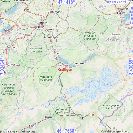
Krattigen GPS coordinates[2]
46° 39' 41.004" North, 7° 43' 39.972" East
| Map corner | latitude | longitude |
|---|---|---|
| Upper-left | 47.1418°, | 7.02464° |
| Center: | 46.66139°, | 7.72777° |
| Lower-right: | 46.17668°, | 8.43089° |
| Map W x H: | 107.3×107.3 km | = 66.7×66.7mi |
| max Lat: | 47.76737° ⇑79.9% North |
| Krattigen: | 46.66139° |
| min Lat: | ⇓20.1% South 45.83203° |
| min Long | Krattigen | max Long |
| 5.97153° | 7.72777° | 10.44624° |
| W 32.4%⇐ | ⇒67.6% E |
Elevation
Elevation of Krattigen is 708 m = 2323 ft, and this is 149.8 m = 491 ft above average elevation for this country.
| Max E: |
1845 m = 6053 ft | 16.8% |
| Krattigen | 708 m 2323 ft | |
| Avg. | 558.2 m = 1831 ft | |
Min E: |
197 m = 646 ft | 83.2% |
See also: Switzerland elevation on elevation.city.
Geographical zone
Krattigen is located in North temperate zone (between Tropic of Cancer and the Arctic Circle). Distance of this North polar circle is 2212.9 km =1375 mi to North.| Distance of | km | miles | from Krattigen |
|---|---|---|---|
| North Pole | 4818.8 | 2994.3 | to North |
| Arctic Circle | 2212.9 | 1375 | to North |
| Tropic Cancer | 2582.3 | 1604.6 | to South |
| Equator | 5188.3 | 3223.9 | to South |


Nearby cities:
15 places around Krattigen: (largest is in red/bold)
• Aeschi b. Spiez
2.4 km =1.5 mi,  262°
262°
• Beatenberg
6.6 km =4.1 mi,  50°
50°
• Därligen
6.1 km =3.8 mi,  89°
89°
• Frutigen
10.2 km =6.3 mi,  215°
215°
• Heiligenschwendi
10.5 km =6.5 mi,  341°
341°
• Hilterfingen
9.6 km =6 mi,  328°
328°
• Interlaken
10.9 km =6.8 mi,  76°
76°
• Leissigen
3.7 km =2.3 mi,  101°
101°
• Matten
10.9 km =6.8 mi, 80°
• Reutigen
8.9 km =5.5 mi,  293°
293°
• Sigriswil
6.2 km =3.9 mi,  349°
349°
• Spiez
3.8 km =2.4 mi,  312°
312°
• Unterseen
9.5 km =5.9 mi,  73°
73°
• Wilderswil
10.2 km =6.3 mi, 88°
• Wimmis
6.9 km =4.3 mi,  283°
283°
Sources, notices
• [Note1] Compared only with cities in Switzerland existing in our database
• [Src1] Map data: © OpenStreetMap contributors (CC-BY-SA)
• [Src2] Other city data from geonames.org with taken over terms of usage.
• [Src3] Geographical zone / Annual Mean Temperature by Robert A. Rohde @ Wikipedia
