Iserables geodata
Iserables (Valais) is a populated place; located in Switzerland in Europe/Zurich (GMT+2) time zone. With population of 918 people, there are 1394 cities with bigger population in this country. Compared to other cities in Switzerland, 96.3% of cities are located further ↑North; 80.9% of cities are located further →East and 96.6% of cities have lower elevation than Iserables. Note1


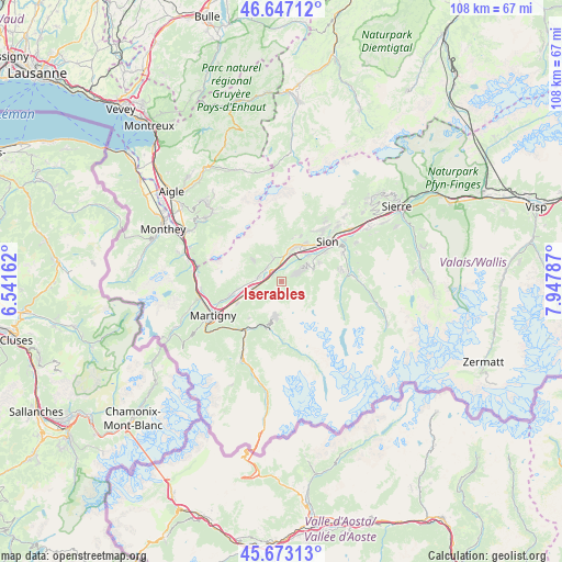
Iserables GPS coordinates[2]
46° 9' 44.208" North, 7° 14' 41.064" East
| Map corner | latitude | longitude |
|---|---|---|
| Upper-left | 46.64712°, | 6.54162° |
| Center: | 46.16228°, | 7.24474° |
| Lower-right: | 45.67313°, | 7.94787° |
| Map W x H: | 108.3×108.3 km | = 67.3×67.3mi |
| max Lat: | 47.76737° ⇑96.3% North |
| Iserables: | 46.16228° |
| min Lat: | ⇓3.7% South 45.83203° |
| min Long | Iserables | max Long |
| 5.97153° | 7.24474° | 10.44624° |
| W 19.1%⇐ | ⇒80.9% E |
Elevation
Elevation of Iserables is 1125 m = 3691 ft, and this is 566.8 m = 1860 ft above average elevation for this country.
| Max E: |
1845 m = 6053 ft | 3.4% |
| Iserables | 1125 m 3691 ft | |
| Avg. | 558.2 m = 1831 ft | |
Min E: |
197 m = 646 ft | 96.6% |
See also: Switzerland elevation on elevation.city.
Geographical zone
Iserables is located in North temperate zone (between Tropic of Cancer and the Arctic Circle). Distance of this North polar circle is 2268.4 km =1409.5 mi to North.| Distance of | km | miles | from Iserables |
|---|---|---|---|
| North Pole | 4874.3 | 3028.7 | to North |
| Arctic Circle | 2268.4 | 1409.5 | to North |
| Tropic Cancer | 2526.8 | 1570.1 | to South |
| Equator | 5132.8 | 3189.4 | to South |


Nearby cities:
15 places around Iserables: (largest is in red/bold)
• Ardon
5.4 km =3.4 mi,  12°
12°
• Bagnes
9 km =5.6 mi,  193°
193°
• Basse-Nendaz
6 km =3.7 mi,  59°
59°
• Chamoson
4.8 km =3 mi,  339°
339°
• Charrat
9.7 km =6 mi,  244°
244°
• Conthey
8.2 km =5.1 mi,  33°
33°
• Fully
10.4 km =6.5 mi,  255°
255°
• Leytron
3.9 km =2.4 mi,  313°
313°
• Riddes
2 km =1.2 mi, 305°
• Saillon
4.5 km =2.8 mi,  281°
281°
• Saxon
5.5 km =3.4 mi, 255°
• Sembrancher
11.8 km =7.3 mi,  216°
216°
• Sitten
11.2 km =7 mi,  49°
49°
• Verbier
7 km =4.3 mi, 191°
• Vétroz
7.1 km =4.4 mi,  21°
21°
Sources, notices
• [Note1] Compared only with cities in Switzerland existing in our database
• [Src1] Map data: © OpenStreetMap contributors (CC-BY-SA)
• [Src2] Other city data from geonames.org with taken over terms of usage.
• [Src3] Geographical zone / Annual Mean Temperature by Robert A. Rohde @ Wikipedia
