Bagnes geodata
Bagnes (Valais) is a populated place; located in Switzerland in Europe/Zurich (GMT+2) time zone. With population of 6,626 people, there are 247 cities with bigger population in this country. Compared to other cities in Switzerland, 97.6% of cities are located further ↑North; 81.6% of cities are located further →East and 93% of cities have lower elevation than Bagnes. Note1


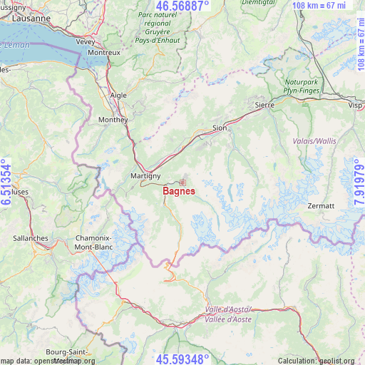
Bagnes GPS coordinates[2]
46° 4' 59.988" North, 7° 13' 0.012" East
| Map corner | latitude | longitude |
|---|---|---|
| Upper-left | 46.56887°, | 6.51354° |
| Center: | 46.08333°, | 7.21667° |
| Lower-right: | 45.59348°, | 7.91979° |
| Map W x H: | 108.5×108.5 km | = 67.4×67.4mi |
| max Lat: | 47.76737° ⇑97.6% North |
| Bagnes: | 46.08333° |
| min Lat: | ⇓2.4% South 45.83203° |
| min Long | Bagnes | max Long |
| 5.97153° | 7.21667° | 10.44624° |
| W 18.4%⇐ | ⇒81.6% E |
Elevation
Elevation of Bagnes is 924 m = 3031 ft, and this is 365.8 m = 1200 ft above average elevation for this country.
| Max E: |
1845 m = 6053 ft | 7% |
| Bagnes | 924 m 3031 ft | |
| Avg. | 558.2 m = 1831 ft | |
Min E: |
197 m = 646 ft | 93% |
See also: Switzerland elevation on elevation.city.
Geographical zone
Bagnes is located in North temperate zone (between Tropic of Cancer and the Arctic Circle). Distance of this North polar circle is 2277.2 km =1415 mi to North.| Distance of | km | miles | from Bagnes |
|---|---|---|---|
| North Pole | 4883.1 | 3034.2 | to North |
| Arctic Circle | 2277.2 | 1415 | to North |
| Tropic Cancer | 2518.1 | 1564.7 | to South |
| Equator | 5124 | 3183.9 | to South |


Nearby cities:
15 places around Bagnes: (largest is in red/bold)
• Basse-Nendaz
13.9 km =8.6 mi,  31°
31°
• Chamoson
13.3 km =8.3 mi,  2°
2°
• Charrat
8 km =5 mi,  305°
305°
• Fully
10 km =6.2 mi, 307°
• Iserables
9 km =5.6 mi,  13°
13°
• Leytron
11.5 km =7.1 mi,  356°
356°
• Liddes
10.4 km =6.5 mi,  192°
192°
• Martigny-Combe
12.8 km =8 mi,  267°
267°
• Martigny-Ville
11.3 km =7 mi,  280°
280°
• Orsières
8.2 km =5.1 mi,  222°
222°
• Riddes
10 km =6.2 mi, 3°
• Saillon
9.9 km =6.2 mi,  347°
347°
• Saxon
8 km =5 mi,  336°
336°
• Sembrancher
5 km =3.1 mi,  262°
262°
• Verbier
2 km =1.2 mi,  22°
22°
Sources, notices
• [Note1] Compared only with cities in Switzerland existing in our database
• [Src1] Map data: © OpenStreetMap contributors (CC-BY-SA)
• [Src2] Other city data from geonames.org with taken over terms of usage.
• [Src3] Geographical zone / Annual Mean Temperature by Robert A. Rohde @ Wikipedia
