Hinwil geodata
Hinwil (Zurich) is a seat of a second-order administrative division; located in Switzerland in Europe/Zurich (GMT+2) time zone. With population of 5,488 people, there are 307 cities with bigger population in this country. Compared to other cities in Switzerland, 57.3% of cities are located further ↓South; 82.6% of cities are located further ←West and 70.3% of cities have lower elevation than Hinwil. Note1


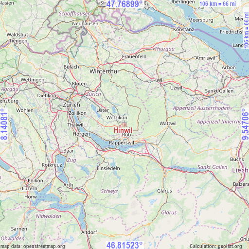
Hinwil GPS coordinates[2]
47° 17' 39.336" North, 8° 50' 38.148" East
| Map corner | latitude | longitude |
|---|---|---|
| Upper-left | 47.76899°, | 8.14081° |
| Center: | 47.29426°, | 8.84393° |
| Lower-right: | 46.81523°, | 9.54706° |
| Map W x H: | 106×106 km | = 65.9×65.9mi |
| max Lat: | 47.76737° ⇑42.7% North |
| Hinwil: | 47.29426° |
| min Lat: | ⇓57.3% South 45.83203° |
| min Long | Hinwil | max Long |
| 5.97153° | 8.84393° | 10.44624° |
| W 82.6%⇐ | ⇒17.4% E |
Elevation
Elevation of Hinwil is 573 m = 1880 ft, and this is 14.8 m = 49 ft above average elevation for this country.
| Max E: |
1845 m = 6053 ft | 29.7% |
| Hinwil | 573 m 1880 ft | |
| Avg. | 558.2 m = 1831 ft | |
Min E: |
197 m = 646 ft | 70.3% |
See also: Switzerland elevation on elevation.city.
Geographical zone
Hinwil is located in North temperate zone (between Tropic of Cancer and the Arctic Circle). Distance of this North polar circle is 2142.5 km =1331.3 mi to North.| Distance of | km | miles | from Hinwil |
|---|---|---|---|
| North Pole | 4748.4 | 2950.5 | to North |
| Arctic Circle | 2142.5 | 1331.3 | to North |
| Tropic Cancer | 2652.7 | 1648.3 | to South |
| Equator | 5258.6 | 3267.5 | to South |


Nearby cities:
15 places around Hinwil: (largest is in red/bold)
• Breitenmatt
3.1 km =1.9 mi,  130°
130°
• Bubikon
3.6 km =2.2 mi,  212°
212°
• Bubikon / Station
3.1 km =1.9 mi, 212°
• Dürnten
1.8 km =1.1 mi,  185°
185°
• Hadlikon
1.3 km =0.8 mi, 126°
• Oberdürnten
2.1 km =1.3 mi,  141°
141°
• Oberkempten
4.2 km =2.6 mi,  335°
335°
• Pilgerhof
3.6 km =2.2 mi,  150°
150°
• Rüti
4.3 km =2.7 mi,  168°
168°
• Rüti / Oberdorf
4.2 km =2.6 mi,  157°
157°
• Rüti / Westlicher Dorfteil
4.3 km =2.7 mi,  179°
179°
• Tann
2.9 km =1.8 mi, 170°
• Tann / Tann (Dorfkern)
3.3 km =2.1 mi, 171°
• Wernetshausen
1.7 km =1.1 mi,  70°
70°
• Wetzikon / Unter-Wetzikon
4.5 km =2.8 mi,  302°
302°
Sources, notices
• [Note1] Compared only with cities in Switzerland existing in our database
• [Src1] Map data: © OpenStreetMap contributors (CC-BY-SA)
• [Src2] Other city data from geonames.org with taken over terms of usage.
• [Src3] Geographical zone / Annual Mean Temperature by Robert A. Rohde @ Wikipedia
