Rüti / Oberdorf geodata
Rüti / Oberdorf (Zurich) is a section of populated place; located in Switzerland in Europe/Zurich (GMT+2) time zone. With population of 2,875 people, there are 612 cities with bigger population in this country. Compared to other cities in Switzerland, 52.8% of cities are located further ↓South; 83.8% of cities are located further ←West and 63.6% of cities have lower elevation than Rüti / Oberdorf. Note1


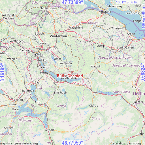
Rüti / Oberdorf GPS coordinates[2]
47° 15' 32.184" North, 8° 51' 54.432" East
| Map corner | latitude | longitude |
|---|---|---|
| Upper-left | 47.73399°, | 8.16199° |
| Center: | 47.25894°, | 8.86512° |
| Lower-right: | 46.77959°, | 9.56824° |
| Map W x H: | 106.1×106.1 km | = 65.9×65.9mi |
| max Lat: | 47.76737° ⇑47.2% North |
| Rüti / Oberdorf: | 47.25894° |
| min Lat: | ⇓52.8% South 45.83203° |
| min Long | Rüti / Oberdor | max Long |
| 5.97153° | 8.86512° | 10.44624° |
| W 83.8%⇐ | ⇒16.2% E |
Elevation
Elevation of Rüti / Oberdorf is 540 m = 1772 ft, and this is 18.2 m = 60 ft below average elevation for this country.
| Max E: |
1845 m = 6053 ft | 36.4% |
| Avg. | 558.2 m = 1831 ft | |
| Rüti / Oberdorf | 540 m = 1772 ft | |
Min E: |
197 m = 646 ft | 63.6% |
See also: Switzerland elevation on elevation.city.
Geographical zone
Rüti / Oberdorf is located in North temperate zone (between Tropic of Cancer and the Arctic Circle). Distance of this North polar circle is 2146.5 km =1333.8 mi to North.| Distance of | km | miles | from Rüti / Oberdorf |
|---|---|---|---|
| North Pole | 4752.4 | 2953 | to North |
| Arctic Circle | 2146.5 | 1333.8 | to North |
| Tropic Cancer | 2648.8 | 1645.9 | to South |
| Equator | 5254.7 | 3265.1 | to South |


Nearby cities:
15 places around Rüti / Oberdorf: (largest is in red/bold)
• Breitenmatt
2.1 km =1.3 mi,  20°
20°
• Bubikon
3.7 km =2.3 mi,  284°
284°
• Bubikon / Station
3.5 km =2.2 mi,  292°
292°
• Dürnten
2.8 km =1.7 mi,  320°
320°
• Hadlikon
3.2 km =2 mi,  349°
349°
• Hinwil
4.2 km =2.6 mi,  337°
337°
• Jona
3.8 km =2.4 mi,  211°
211°
• Oberdürnten
2.3 km =1.4 mi, 353°
• Pilgerhof
0.8 km =0.5 mi,  10°
10°
• Rüti
0.8 km =0.5 mi,  245°
245°
• Rüti / Dorfzentrum, Südl. Teil
0.9 km =0.6 mi,  227°
227°
• Rüti / Westlicher Dorfteil
1.6 km =1 mi,  255°
255°
• Tann
1.6 km =1 mi,  314°
314°
• Tann / Tann (Dorfkern)
1.3 km =0.8 mi,  301°
301°
• Wald
4.1 km =2.5 mi,  62°
62°
Sources, notices
• [Note1] Compared only with cities in Switzerland existing in our database
• [Src1] Map data: © OpenStreetMap contributors (CC-BY-SA)
• [Src2] Other city data from geonames.org with taken over terms of usage.
• [Src3] Geographical zone / Annual Mean Temperature by Robert A. Rohde @ Wikipedia
