Bubikon / Station geodata
Bubikon / Station (Zurich) is a section of populated place; located in Switzerland in Europe/Zurich (GMT+2) time zone. With population of 732 people, there are 1558 cities with bigger population in this country. Compared to other cities in Switzerland, 54.4% of cities are located further ↓South; 82% of cities are located further ←West and 59.5% of cities have lower elevation than Bubikon / Station. Note1


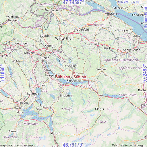
Bubikon / Station GPS coordinates[2]
47° 16' 15.708" North, 8° 49' 18.48" East
| Map corner | latitude | longitude |
|---|---|---|
| Upper-left | 47.74597°, | 8.11868° |
| Center: | 47.27103°, | 8.8218° |
| Lower-right: | 46.79179°, | 9.52493° |
| Map W x H: | 106.1×106.1 km | = 65.9×65.9mi |
| max Lat: | 47.76737° ⇑45.6% North |
| Bubikon / Station: | 47.27103° |
| min Lat: | ⇓54.4% South 45.83203° |
| min Long | Bubikon / Stati | max Long |
| 5.97153° | 8.8218° | 10.44624° |
| W 82%⇐ | ⇒18% E |
Elevation
Elevation of Bubikon / Station is 516 m = 1693 ft, and this is 42.2 m = 138 ft below average elevation for this country.
| Max E: |
1845 m = 6053 ft | 40.5% |
| Avg. | 558.2 m = 1831 ft | |
| Bubikon / Station | 516 m = 1693 ft | |
Min E: |
197 m = 646 ft | 59.5% |
See also: Switzerland elevation on elevation.city.
Geographical zone
Bubikon / Station is located in North temperate zone (between Tropic of Cancer and the Arctic Circle). Distance of this North polar circle is 2145.1 km =1332.9 mi to North.| Distance of | km | miles | from Bubikon / Station |
|---|---|---|---|
| North Pole | 4751 | 2952.1 | to North |
| Arctic Circle | 2145.1 | 1332.9 | to North |
| Tropic Cancer | 2650.1 | 1646.7 | to South |
| Equator | 5256 | 3265.9 | to South |


Nearby cities:
15 places around Bubikon / Station: (largest is in red/bold)
• Bubikon
0.5 km =0.3 mi,  213°
213°
• Dürnten
1.7 km =1.1 mi,  60°
60°
• Hadlikon
3.2 km =2 mi, 55°
• Hinwil
3.1 km =1.9 mi,  32°
32°
• Hombrechtikon / Bochslen
3.9 km =2.4 mi,  242°
242°
• Hombrechtikon / Tobel
3.6 km =2.2 mi, 237°
• Oberdürnten
3.1 km =1.9 mi,  72°
72°
• Pilgerhof
3.5 km =2.2 mi,  99°
99°
• Rüti
3 km =1.9 mi,  123°
123°
• Rüti / Dorfzentrum, Südl. Teil
3.3 km =2.1 mi,  126°
126°
• Rüti / Oberdorf
3.5 km =2.2 mi,  112°
112°
• Rüti / Westlicher Dorfteil
2.5 km =1.6 mi, 134°
• Tann
2.2 km =1.4 mi, 96°
• Tann / Tann (Dorfkern)
2.3 km =1.4 mi, 107°
• Wolfhausen
2.4 km =1.5 mi,  226°
226°
Sources, notices
• [Note1] Compared only with cities in Switzerland existing in our database
• [Src1] Map data: © OpenStreetMap contributors (CC-BY-SA)
• [Src2] Other city data from geonames.org with taken over terms of usage.
• [Src3] Geographical zone / Annual Mean Temperature by Robert A. Rohde @ Wikipedia
