Hinterrhein geodata
Hinterrhein (Grisons) is a seat of a second-order administrative division; located in Switzerland in Europe/Zurich (GMT+2) time zone. With population of 108 people, there are 1819 cities with bigger population in this country. Compared to other cities in Switzerland, 84.4% of cities are located further ↑North; 92.8% of cities are located further ←West and 99.4% of cities have lower elevation than Hinterrhein. Note1


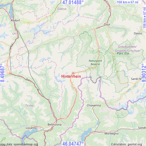
Hinterrhein GPS coordinates[2]
46° 31' 59.988" North, 9° 12' 0" East
| Map corner | latitude | longitude |
|---|---|---|
| Upper-left | 47.01488°, | 8.49687° |
| Center: | 46.53333°, | 9.2° |
| Lower-right: | 46.04747°, | 9.90312° |
| Map W x H: | 107.6×107.6 km | = 66.9×66.9mi |
| max Lat: | 47.76737° ⇑84.4% North |
| Hinterrhein: | 46.53333° |
| min Lat: | ⇓15.6% South 45.83203° |
| min Long | Hinterrhein | max Long |
| 5.97153° | 9.2° | 10.44624° |
| W 92.8%⇐ | ⇒7.2% E |
Elevation
Elevation of Hinterrhein is 1668 m = 5472 ft, and this is 1109.8 m = 3641 ft above average elevation for this country.
| Max E: |
1845 m = 6053 ft | 0.59999999999999% |
| Hinterrhein | 1668 m 5472 ft | |
| Avg. | 558.2 m = 1831 ft | |
Min E: |
197 m = 646 ft | 99.4% |
See also: Switzerland elevation on elevation.city.
Geographical zone
Hinterrhein is located in North temperate zone (between Tropic of Cancer and the Arctic Circle). Distance of this North polar circle is 2227.2 km =1383.9 mi to North.| Distance of | km | miles | from Hinterrhein |
|---|---|---|---|
| North Pole | 4833 | 3003.1 | to North |
| Arctic Circle | 2227.2 | 1383.9 | to North |
| Tropic Cancer | 2568.1 | 1595.7 | to South |
| Equator | 5174 | 3215 | to South |


Nearby cities:
15 places around Hinterrhein: (largest is in red/bold)
• Acquarossa
21.6 km =13.4 mi,  246°
246°
• Andeer
19 km =11.8 mi,  65°
65°
• Arvigo
26.6 km =16.5 mi,  194°
194°
• Biasca
26.2 km =16.3 mi,  222°
222°
• Braggio
26.3 km =16.3 mi, 192°
• Cauco
22.8 km =14.2 mi,  195°
195°
• Donat
20.5 km =12.7 mi,  58°
58°
• Ilanz
26.8 km =16.7 mi,  0°
0°
• Lostallo
24.5 km =15.2 mi,  180°
180°
• Malvaglia
21.9 km =13.6 mi,  229°
229°
• Mesocco
15.7 km =9.8 mi,  170°
170°
• Obersaxen
25.3 km =15.7 mi,  342°
342°
• Sils im Domleschg
26.9 km =16.7 mi,  46°
46°
• Thusis
25.8 km =16 mi, 45°
• Vals Platz
9.4 km =5.8 mi,  350°
350°
Sources, notices
• [Note1] Compared only with cities in Switzerland existing in our database
• [Src1] Map data: © OpenStreetMap contributors (CC-BY-SA)
• [Src2] Other city data from geonames.org with taken over terms of usage.
• [Src3] Geographical zone / Annual Mean Temperature by Robert A. Rohde @ Wikipedia
