Wallisellen / Hof geodata
Wallisellen / Hof (Zurich) is a section of populated place; located in Switzerland in Europe/Zurich (GMT+2) time zone. With population of 902 people, there are 1411 cities with bigger population in this country. Compared to other cities in Switzerland, 75.7% of cities are located further ↓South; 66.8% of cities are located further ←West and 72.4% of cities have higher elevation than Wallisellen / Hof. Note1


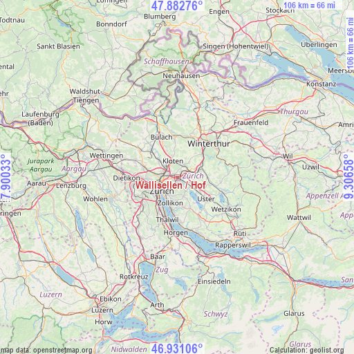
Wallisellen / Hof GPS coordinates[2]
47° 24' 32.616" North, 8° 36' 12.42" East
| Map corner | latitude | longitude |
|---|---|---|
| Upper-left | 47.88276°, | 7.90033° |
| Center: | 47.40906°, | 8.60345° |
| Lower-right: | 46.93106°, | 9.30658° |
| Map W x H: | 105.8×105.8 km | = 65.7×65.7mi |
| max Lat: | 47.76737° ⇑24.3% North |
| Wallisellen / Hof: | 47.40906° |
| min Lat: | ⇓75.7% South 45.83203° |
| min Long | Wallisellen / H | max Long |
| 5.97153° | 8.60345° | 10.44624° |
| W 66.8%⇐ | ⇒33.2% E |
Elevation
Elevation of Wallisellen / Hof is 436 m = 1430 ft, and this is 122.2 m = 401 ft below average elevation for this country.
| Max E: |
1845 m = 6053 ft | 72.4% |
| Avg. | 558.2 m = 1831 ft | |
| Wallisellen / Hof | 436 m = 1430 ft | |
Min E: |
197 m = 646 ft | 27.6% |
See also: Switzerland elevation on elevation.city.
Geographical zone
Wallisellen / Hof is located in North temperate zone (between Tropic of Cancer and the Arctic Circle). Distance of this North polar circle is 2129.8 km =1323.4 mi to North.| Distance of | km | miles | from Wallisellen / Hof |
|---|---|---|---|
| North Pole | 4735.7 | 2942.6 | to North |
| Arctic Circle | 2129.8 | 1323.4 | to North |
| Tropic Cancer | 2665.5 | 1656.3 | to South |
| Equator | 5271.4 | 3275.5 | to South |


Nearby cities:
15 places around Wallisellen / Hof: (largest is in red/bold)
• Dietlikon / Dietlikon (Dorf)
1.5 km =0.9 mi,  48°
48°
• Dietlikon / Eichwiesen
1.7 km =1.1 mi, 49°
• Dübendorf
1.7 km =1.1 mi,  138°
138°
• Dübendorf / Birchlen
1.3 km =0.8 mi,  158°
158°
• Dübendorf / Heugatterstrasse
1.4 km =0.9 mi, 160°
• Dübendorf / Im Zwinggarten
1.1 km =0.7 mi,  117°
117°
• Dübendorf / Meiershofstrasse
1.5 km =0.9 mi,  145°
145°
• Dübendorf / Stägenbuck
1.6 km =1 mi, 117°
• Dübendorf / Vogelquartier
1.7 km =1.1 mi, 157°
• Dübendorf / Wasserfurren
1.8 km =1.1 mi,  167°
167°
• Wallisellen
0.8 km =0.5 mi,  322°
322°
• Wallisellen / Rieden
1 km =0.6 mi,  345°
345°
• Wallisellen / Wallisellen-Ost
0.8 km =0.5 mi, 322°
• Wallisellen / Wallisellen-West
1.7 km =1.1 mi,  310°
310°
• Zürich (Kreis 12) / Hirzenbach
1.5 km =0.9 mi,  238°
238°
Sources, notices
• [Note1] Compared only with cities in Switzerland existing in our database
• [Src1] Map data: © OpenStreetMap contributors (CC-BY-SA)
• [Src2] Other city data from geonames.org with taken over terms of usage.
• [Src3] Geographical zone / Annual Mean Temperature by Robert A. Rohde @ Wikipedia
